Mike Dross

About Mike Dross

Scientist / Meteorologist. Founder & President of Wright-Weather.com.

Significant Hardware Upgrades to Wright-Weather.com This Week. Possible Interruptions

We are pleased to announce that we have made a major investment in new hardware and will be deploying a number of new Dell Enterprise Servers over the next several days.

These new servers will increase our computational processing capacity by 561% and our disk storage system will increase by over 600% .  Also,  our internal network backbone will increase by 10x.  We are also moving to a solid state storage array which will allow us to process data much faster than we have been able to in the past.

We are moving these new servers into a data center with some of the best peering and fastest internet connectivity available, which will result in a extremely responsive user experience for our customers.

As we make this transition off some of our older hardware to the new servers at the new location, there may be some temporary interruptions in some of the model data and other graphics for a brief time. We will be doing everything we can to prevent any delays in model production or interruptions to any of the products we generate.

As we get all the servers and systems fully migrated over  in the coming weeks, look for many more new and exciting products from Wright-Weather.com in the coming months.

If you have any questions or see any issues with the site, please do not hesitate to contact us at support at wright-weather.com

Mike Dross
President / Meteorologist
Wright-Weather.com


Severe Weather & Tornado Outbreak Increasingly Likely Saturday From The Lower Ohio Valleys into Mid South

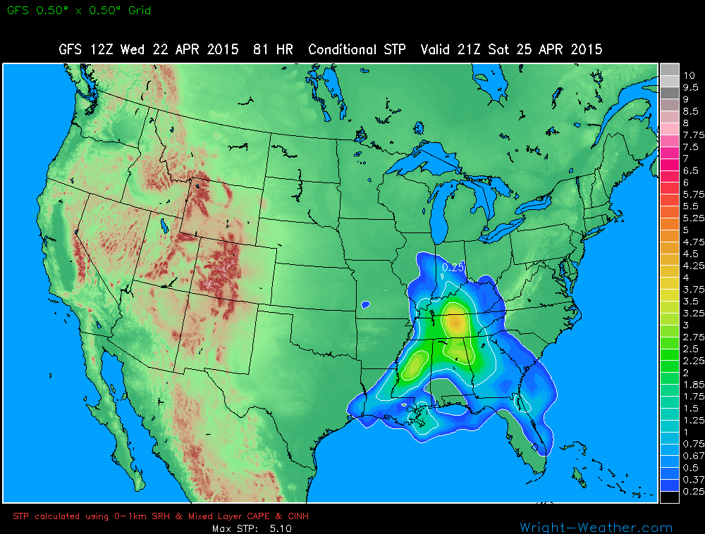
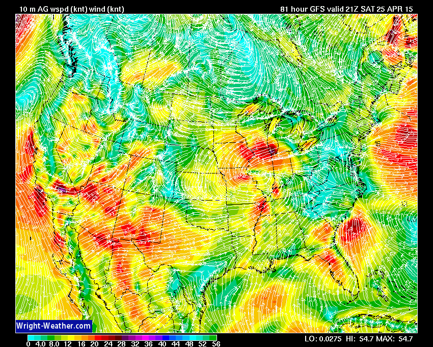
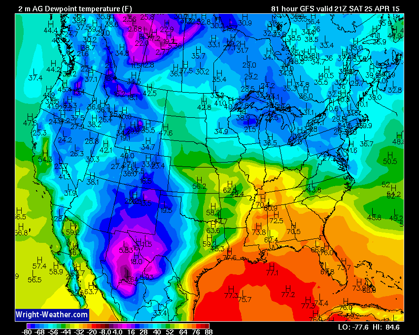
A potent mix of thermodynamic and kinetic forces will become colocated across the lower Ohio and Tennessee Valleys on Saturday to create conditions favorable for destructive, powerful supercells and potentially violent tornadoes.

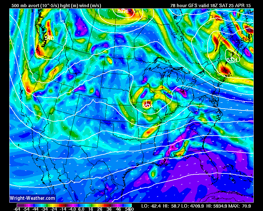
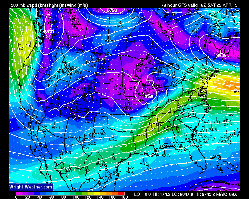
A very powerful jet stream will work across this very unstable airmass with winds at the 200mb level in excess of 150 mph, as depicted by the NWP guidance. It is very rare to have winds of this strength/a jet stream/ directly across the convective layer and will add significantly deep layer shear aiding in ageostrophic imbalances helping to promote mesoscale ascent.  Typically, the mid latitude jet is well removed of the warm/buoyant air mass and rarely directly overlaps.  This could be one of the more unique events and we need to watch this very closely given the kinetic forcing in the upper levels of the troposphere in this upcoming event.

Guidance at this time suggests an early round of showers and non-severe thunderstorms will move through the Mid-South during the early morning hours, followed by partial mid-day clearing allowing for solar insolation and destabilization in the Ohio, Tennessee-Valleys. How these lead convective elements ultimately play out will likely define mesoscale outflow boundaries that will determine where supercells and tornadoes develop later in the day.

This midday-afternoon destabilization combined with a rapidly strengthening wind field at all levels will increase the severe weather risk as a strong upper level (300-200 mb) jet streak punches into the region during the afternoon with a jet wind maximum of nearly 150+ mph closely collocated with the storms

Convection with supercells and the risk for strong to violent tornadoes will develop in association with this powerful  jet/shortwave from the Ohio-Valley southward into Mississippi/Alabama and spread eastward.

The area at highest risk of tornadoes appears to me from Southern Illinois, Southern Indiana,  across Kentucky, Tennessee southward into Central Mississippi and Alabama.  The strongest tornadoes would likely occur in Southern Illinois, Southern Indiana, Kentucky and Tennessee closest to the best 0-1km shear maximum, 0-1km SRH and lowest LCL’s. The tornado risk may spread into western Georgia.

Forecasters and those living in these regions should closely monitor developments and SPC outlooks over the next few days.

On to the maps….


Ice Storm Across Arkansas Monday

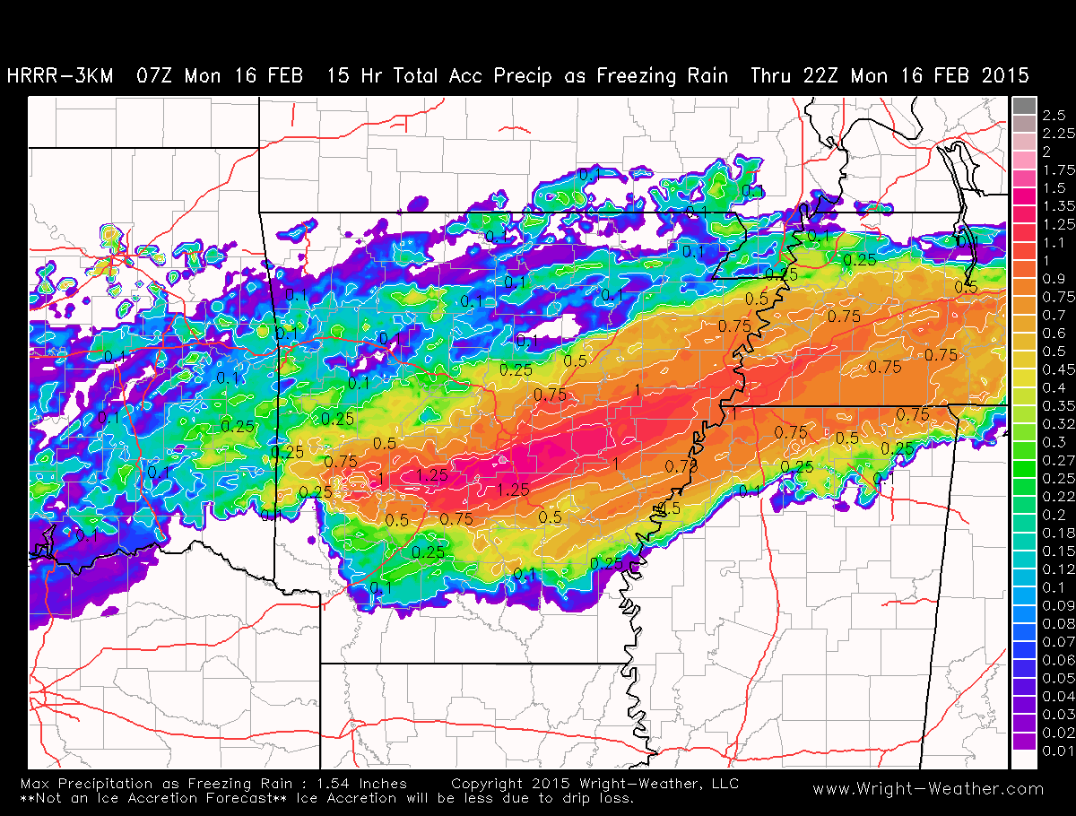
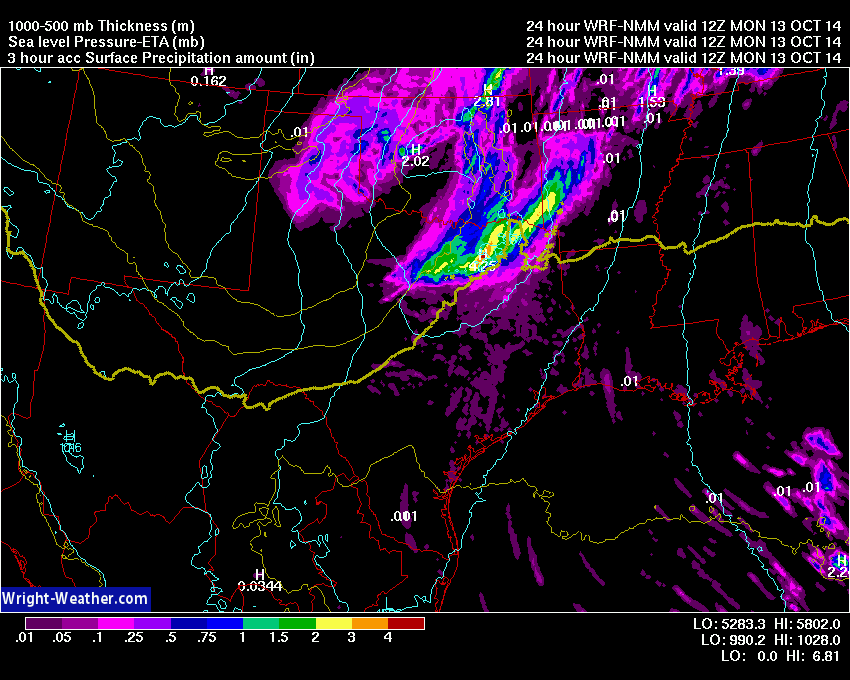
Freezing rain mixed with sleet, locally heavy at times, with embedded elevated convection will continue through the overnight into the morning hours across Arkansas and will produce around 1.00-1.25″ of liquid equivalent precipitation. Much of this will fall in the form of freezing rain across Central Arkansas into Western Tennessee. Ice accretion of 3/8″ to as much 5/8″ of an inch are likely before the precipitation finally ends around noon local time. [18Z].

Ice accretion amounts of 1/2″-5/8″ will bring down large branches and some trees. These can fall on power-lines and disrupt electrical service.  They can also fall on pedestrians and cars. Ice accretion of this amount can cause widespread disruption of power in urban areas and create life threatening hazards with extended loss of power and falling large limbs/trees.

The area in and around Little Rock, AR  is at risk of widespread power outages if the forecast trends continue and ice accretion amounts exceeds 1/2″ later today.

Below.. the total precipitation that will fall as freezing rain as depicted by the HRRR through 22Z. Actual ice accretion will be less due to drip loss.


Click for the latest Little Rock, AR Regional Winter Radar. Updated Every 5 Mins.

New GFS 13km Products

The upgraded GFS model went live today. Over the next several days we will be tuning our systems to optimize how we process the new GFS output.  The are a number of new variables and higher resolution fields available.  We want to make the best use of our resources.  You may notice some slight changes in the model graphics or timing of the products for a few days as we make changes in how we process this data.

We are currently working hard to bring on much higher resolution GFS products on our new Linux servers that we just setup.  We hope to have the new GFS products available soon for our customers.

Thank you for your patience as we continue increasing our computing capacity and product offering here at Wright-Weather.com
Major GFS Upgrade 1/14/15

The GFS model will be upgraded tomorrow, 1/14/15. It is under going a major upgrade. The below PowerPoint link will explain in detail the model physics and initialization changes that have been made, as well as, the effect on model performance.

GFS_implementation_Q1FY15_review_v3

This is a major change to the model and there will likely be new biases and features that we didn’t see in the old GFS due to the higher model resolution. The model is now running at about 13km (near the equator).

We now have several HP DL380 server’s clustered to handle the higher resolution GFS, as well as, HRRR data.

We will have the GFS data in 2 different resolutions. The standard 0.5 degree which have been displaying for years now and soon we will have  surface and other 2D fields  0.25 degree.

Look for the higher resolution data in the coming days. The new GFS based model data at 0.5 degrees will begin tomorrow (01/14/15) however, unless NCEP decides to delay the implementation.

NCEP Data Delivery Problems

NCEP’s servers which we receive some of our model data have been degraded the past 24 hours. Some products will be delayed or possibly incomplete.

Model products which receive via satellite will be on time, which are not affected by the NCEP data servers/network issue.

The GFS NOAAPORT link is:

http://hp2.wright-weather.com/avn.shtml

The NAM NOAAPORT link is:


http://hp2.wright-weather.com/eta.shtml


The latest message sounds encouraging from NCEP. So hopefully any delays will be short-lived:


THE NCEP SUPPORT FOLKS HAVE BROUGHT THE PRIMARY FTP SERVER BACK
UP..FINAL CHECKOUTS HAVE BEEN PERFORMED ON THE PRIMARY FTP SERVER
AND IT HAS BEEN PLACED BACK IN SERVICE AT 0400Z..A PRELIMINARY
CHECK OF FTPPRD AND NOMADS INDICATED THAT DATA IS UP TO
DATE..QUEUES ARE BLEEDIND DOWN..SOME DATA MAYBE STUCK IN QUEUE
BUT FOR THE MOST PART DATA APPEARS TO BE UP TO DATE.. THANKS FOR
YOUR ON-GOING PATIENCE WITH THIS ISSUE TODAY.

SHRUELL/SDM/NCO/NCEP

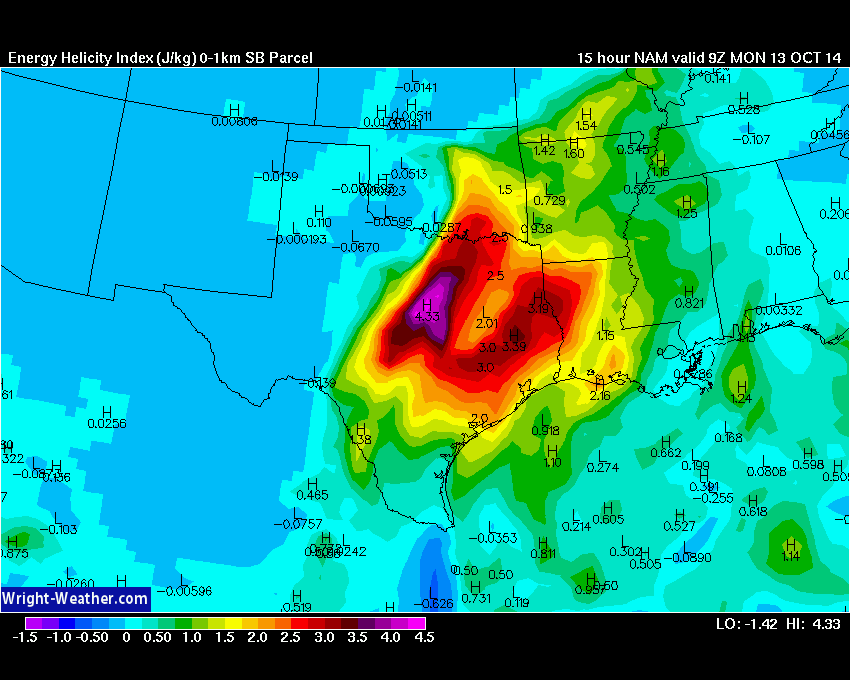
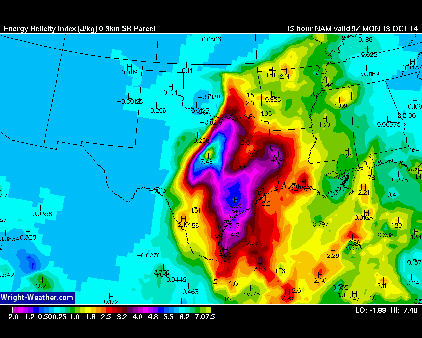
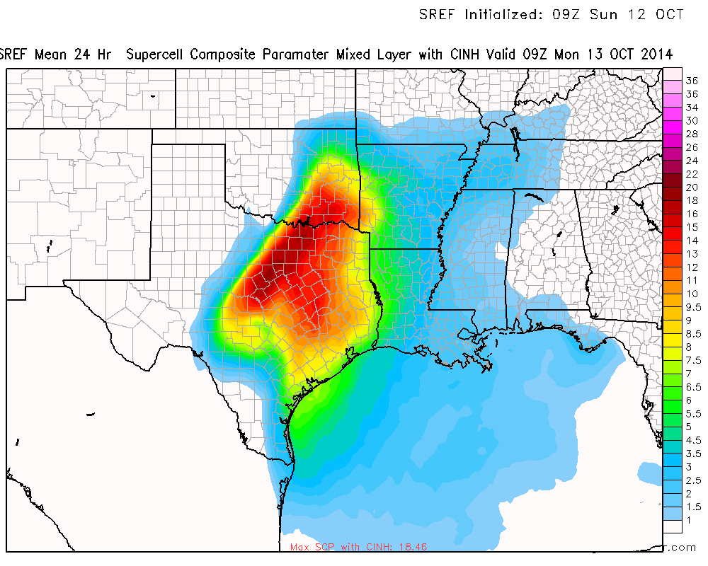
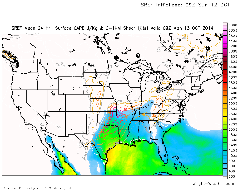
Regional Outbreak of Severe Storms with Possible Tornadoes Expected Sunday Night into Monday Morning Across North Texas into Oklahoma

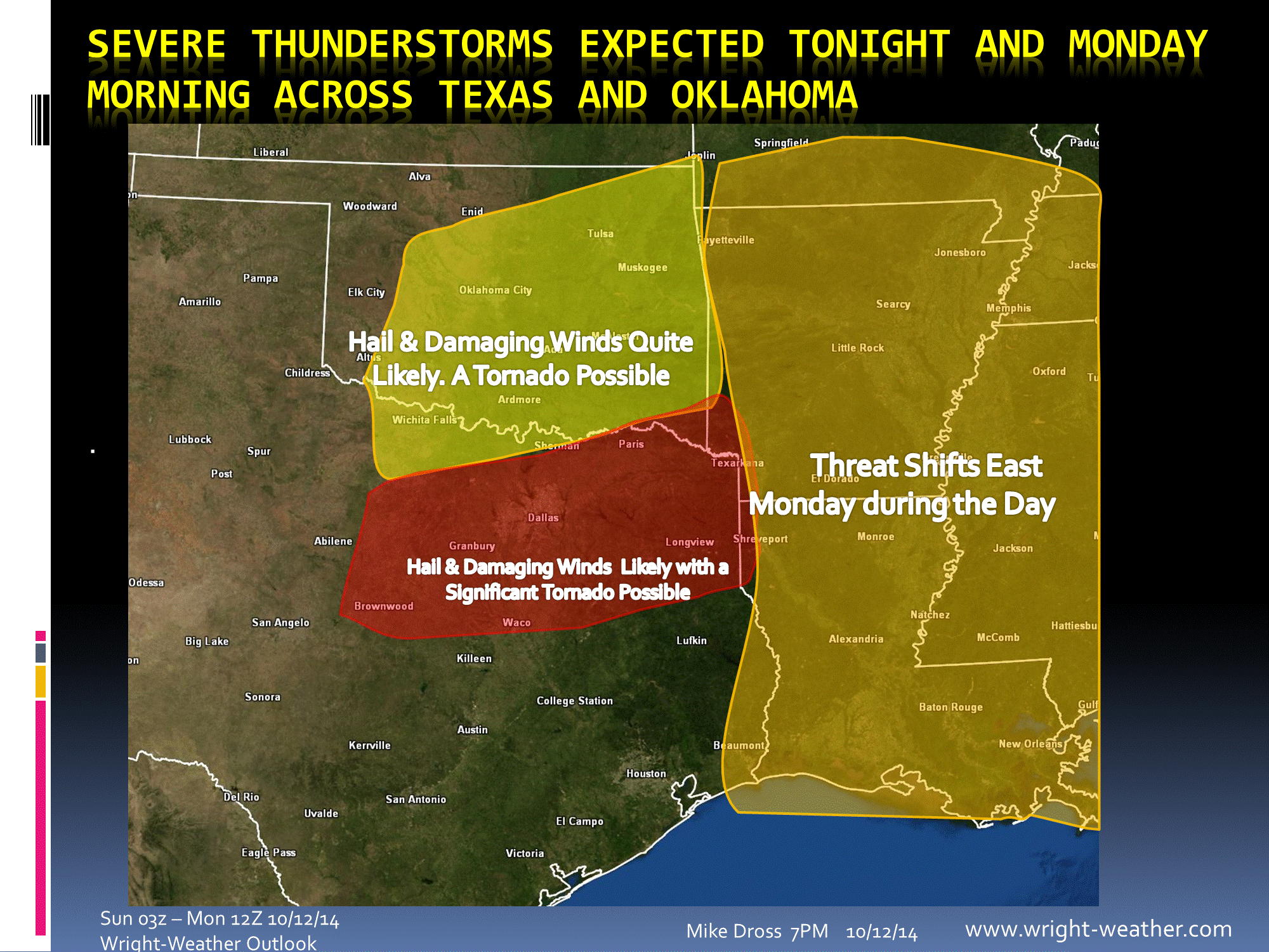
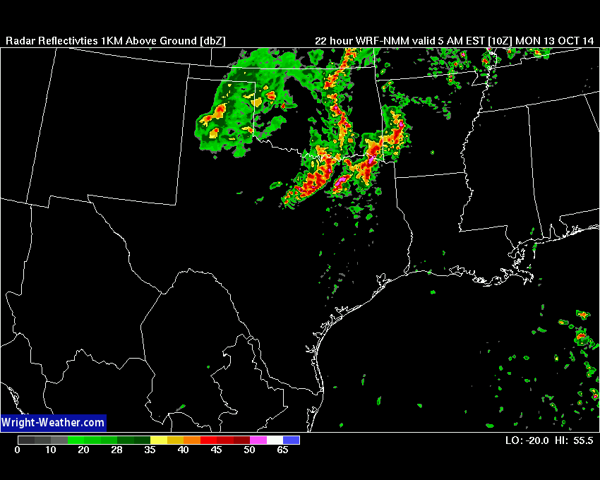
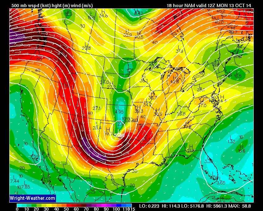
A strong upper level low pressure system will move out of the Rockies into the Southern Plains tonight. This will intensify a surface low pressure system over Western Oklahoma that will move eastward through Oklahoma during the morning on Monday.

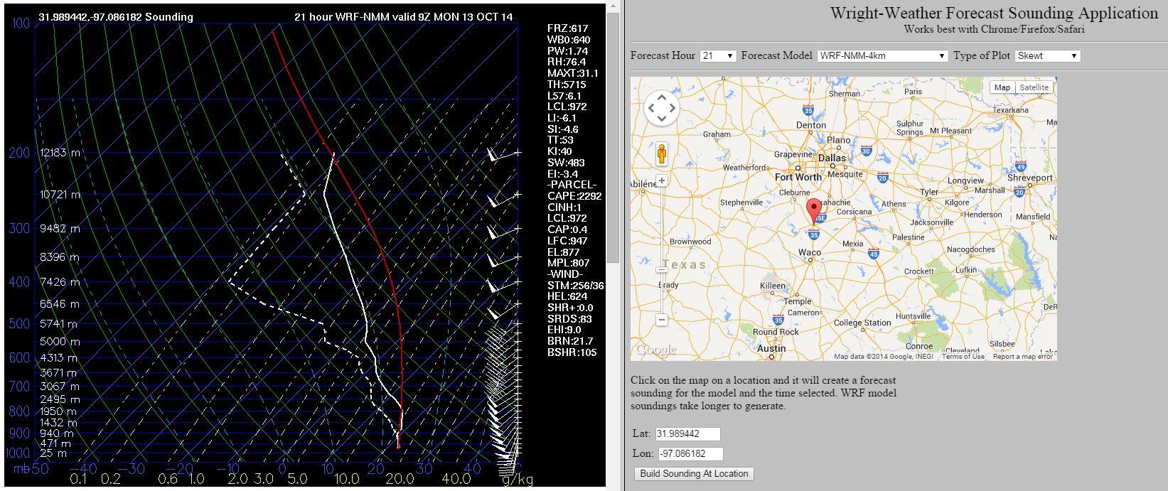
Returning Gulf of Mexico moisture across Central and Eastern Texas with dewpoints in the middle 60s to middle 70s will continue to advect northward overnight.  Showers and thunderstorms are expected to develop across Central & Eastern Texas later this evening, ahead of a cold front that will sweep into North Central Texas around midnight. A triple point region will develop and move near the Red River with other smaller mesoscale boundaries south of the warm front where convection will develop.  A strong line of convection is expected to develop along the cold front as it moves east of the dry line region around 4-5Z.  Storms will likely become severe as they intensify under a strong 60-70kt cyclonic mid-level jet.

Parameters suggest all modes of severe convection are possible. Linear convection is likely to be the most predominant mode, with embedded line echo wave patterns (LEWP’S) with severe wind gusts, but embedded & discrete supercells are also quite likely given the high shear values, very high 0-3km helicities. Bulk Richardson Numbers also favor some discrete supercells along and south of I-20.

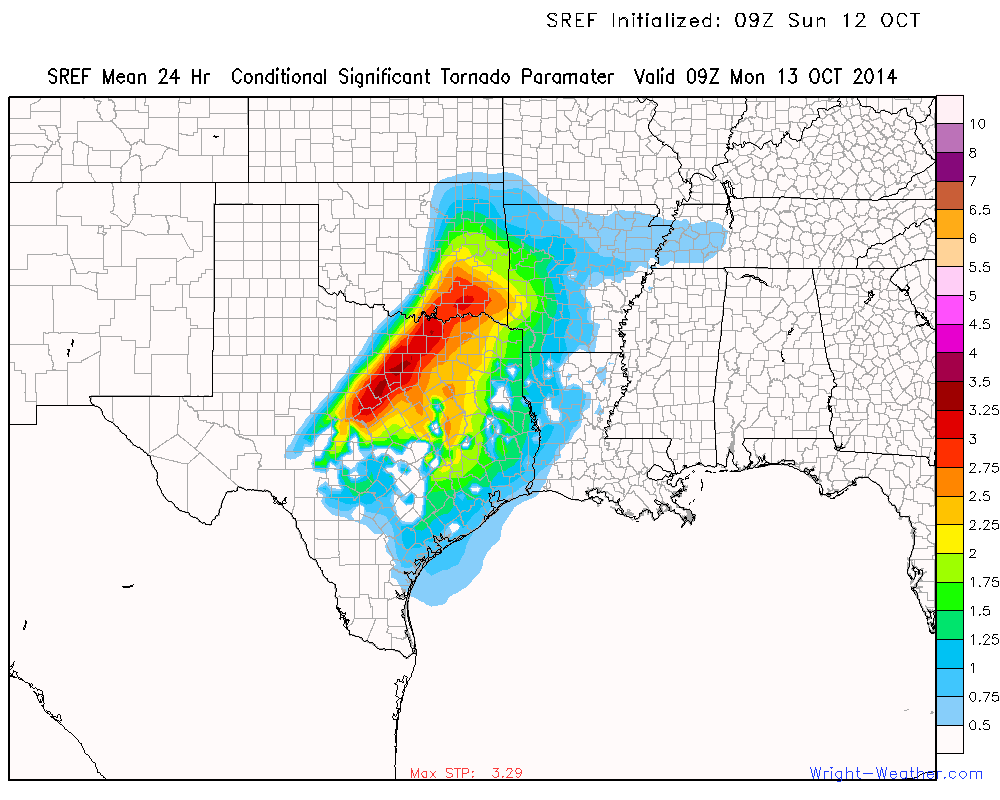
With the low lifted condensation levels, very high 0-1km helicities, shear values and moderate instability.  Some tornadoes are quite possible with the stronger mesocylones.

The region at most risk of supercells is south of the Red River in Texas with an enhanced risk of tornadoes along and south of I-20 where the combination of helicities, shear, CAPE and upper forcing will be maximized.  South of Waco, convective inhibition values will likely be too high to allow for much activity, but if a cell develops may be severe/tornadic.

The severe threat works eastward across Northeast Texas into Arkansas ans Louisiana during the day on Monday.


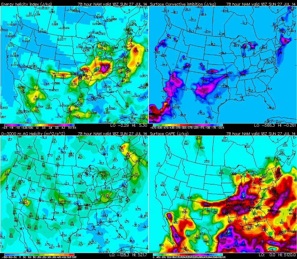
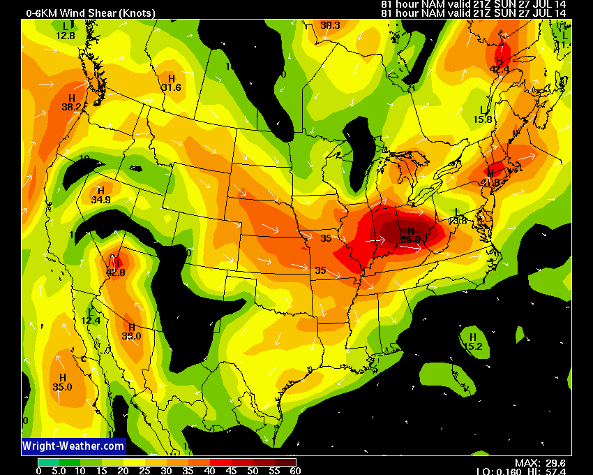
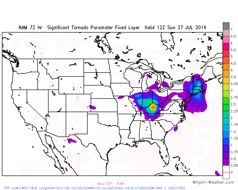
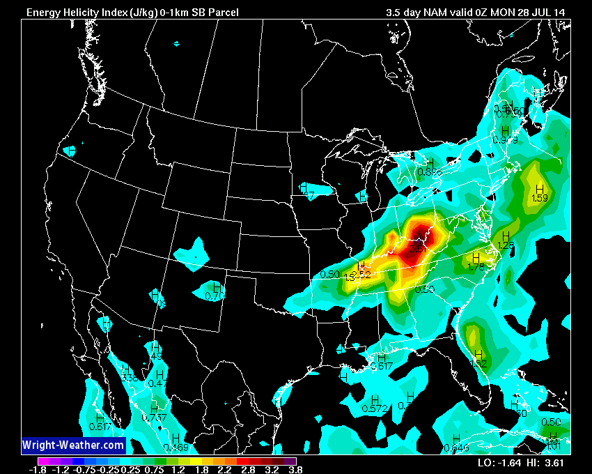
An Outbreak of Severe Storms Expected Across The Mid-West/Ohio-Valley This Weekend

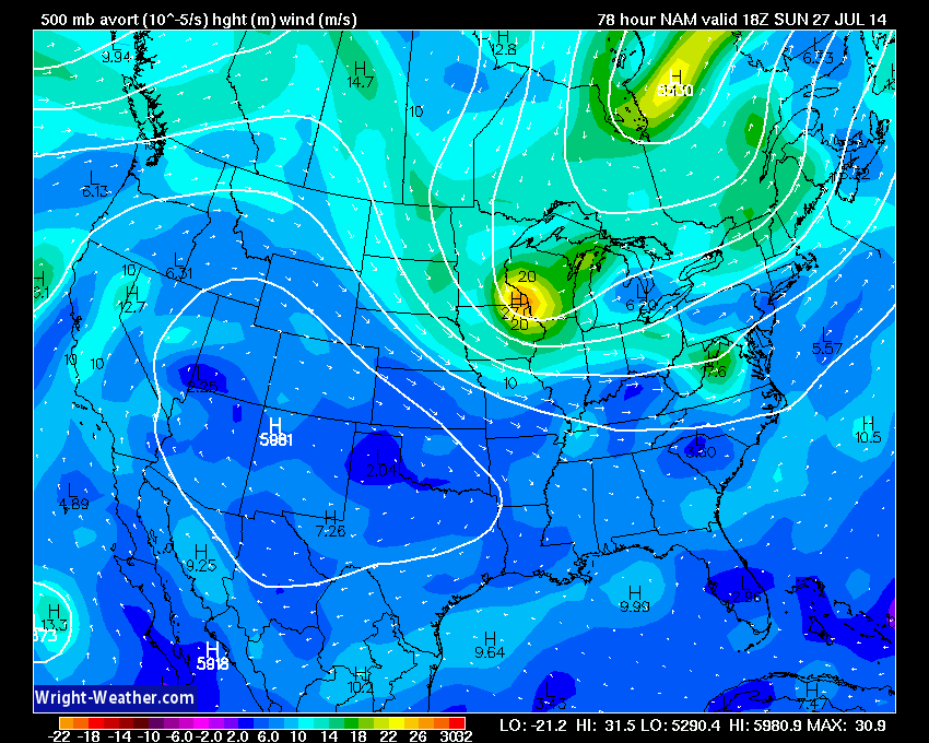
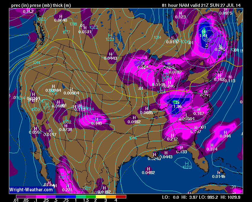
A spring like cold front will move through the Mid-West and combine favorable wind shear with strong instability  Saturday into Sunday afternoon and will likely produce widespread severe thunderstorms with large hail, damaging winds with the possibility of a few tornadoes.

An unseasonably strong upper level short wave will drop southward into the Ohio-Valley on Sunday and will increase the mid and upper level flow across the region.  Favorable instability, bulk shear & moderate helicity will support organized severe thunderstorms beginning on Saturday across IA/MO/IL/IN.  The threat shifts eastward on Sunday into IN/OH/KY/TN/WV.  A tornado threat exist along the quasi-stationary front across northern IN/OH and a conditional threat also exist within the low level theta-e advection zone across eastern Ohio/Kentucky & West Virgina where 0-1KM EHI’s & 0-1Km bulk shear are highest.

Should be an active 48 hour period.  Additional severe storms are likely into Monday across the Northeast and Mid-Atlantic.


Added ECMWF 500mb Winds

Added the ECMWF 500mb winds to the ECMWF regular resolution graphics. These can be useful in projecting the mid-level winds that can aid in organized severe thunderstorm development. These can be found in the drop down menu, as well as, the individual time frames. These are available for the Northern Hemisphere at the moment, but will include all sectors soon.

http://hp2.wright-weather.com/ecmwf.shtml