Damaging Ice Storm Likely Across Georgia, South Carolina

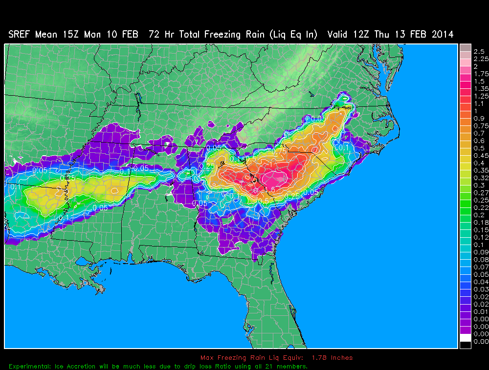
A zone of of prolonged freezing rain will extended the I-20 corridor from Atlanta to Augusta to Columbia, SC.  Model freezing rain liquid equivalent totals in this area exceed 2 inches. While drip loss will be relatively high with accretion efficiencies likely only being in the 30-40% range due to the high precipitation rates and the temperatures likely remaining close to the freezing point, this still yields  radial ice accretion amounts of .50-75″ which would cause widespread electrical distribution disruptions and tree damage.

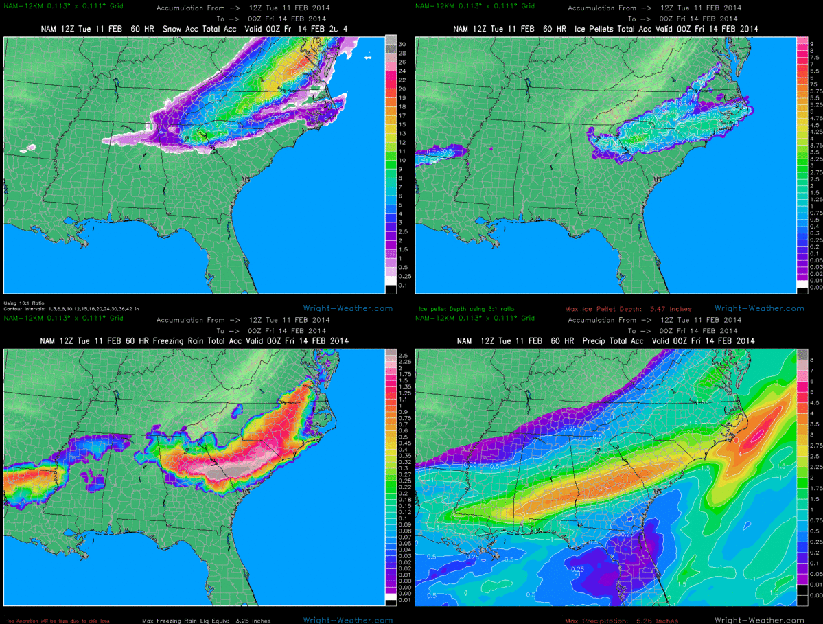
Here are the latest Freezing Rain Graphics.

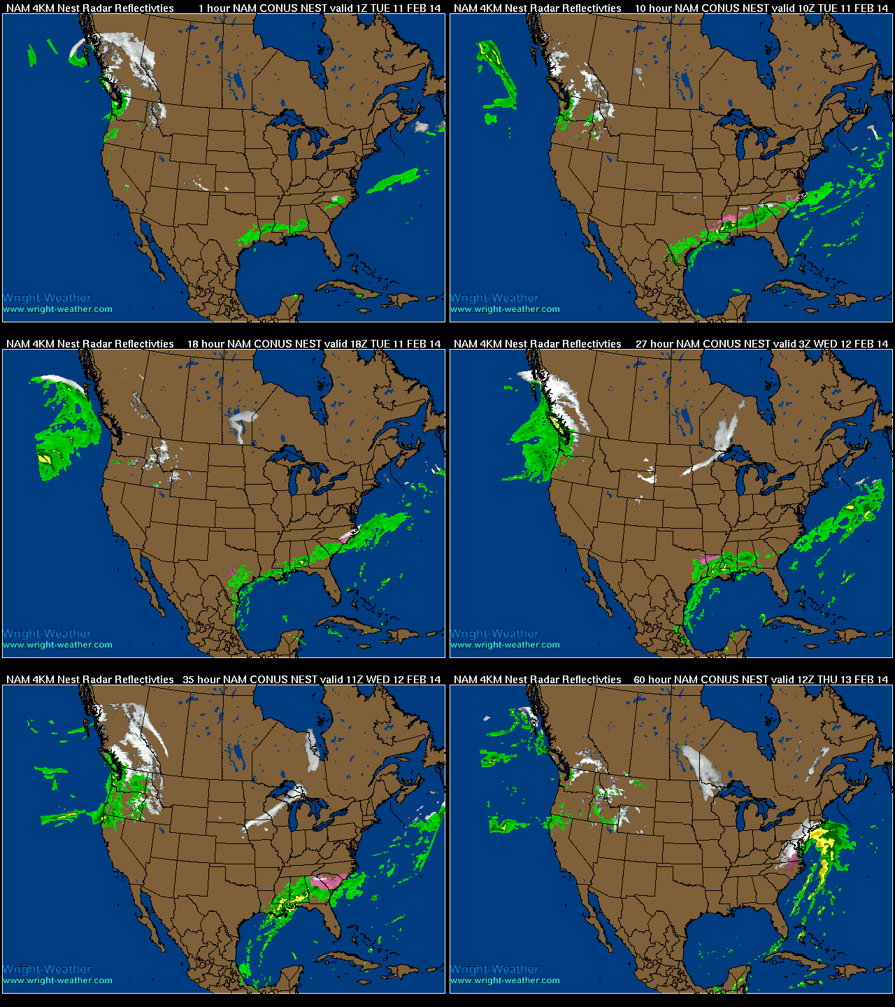
Major Winter Storm To Impact Southeast Then East Coast.

A strong winter storm will bring a variety of winter weather to the Southeastern U.S. as an upper level low develops across the mid-south, in combination with a cold air damming event.  A strong coastal low will strengthen and move up along and just off the Eastern seaboard and bring heavy precipitation to the Mid-Atlantic and into the Northeast

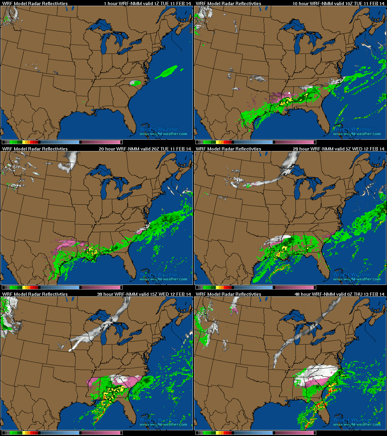
WRF Hourly Winter Radar through Wednesday Evening

NAM 4km 60hr Winter Radar

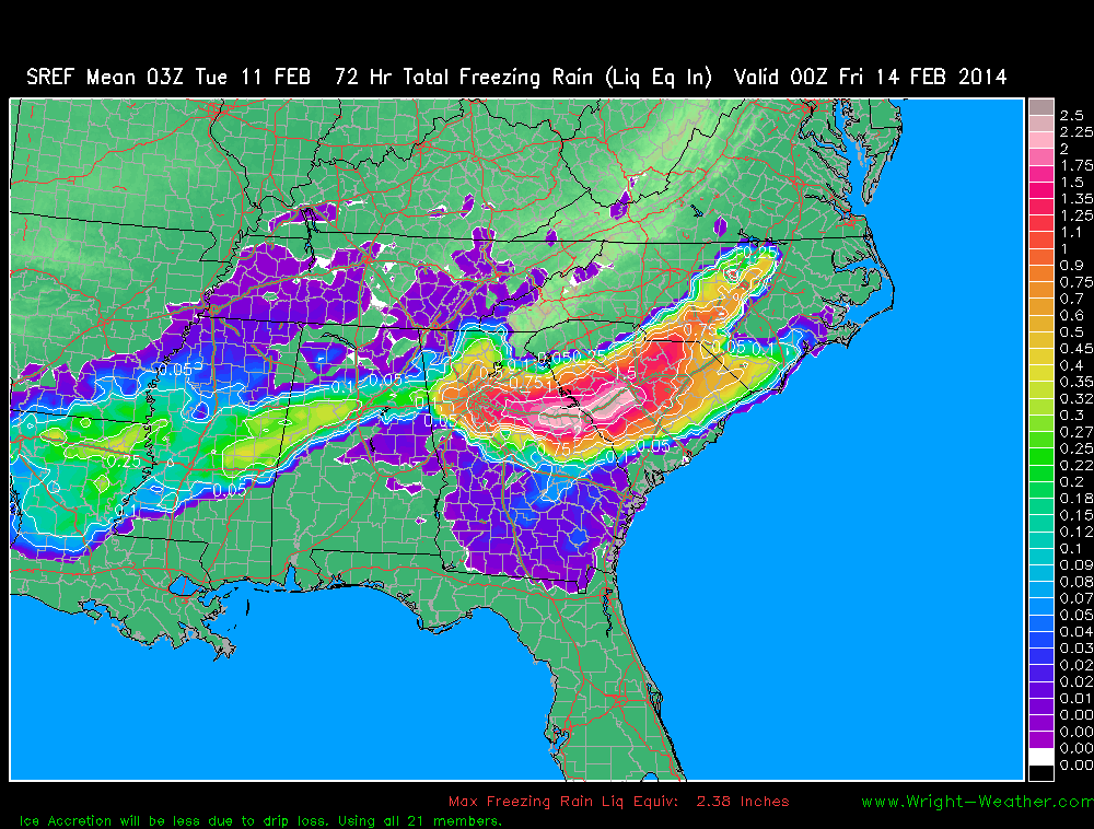
New SREF Accumulated Winter Precipitation Products

New Short Range Ensemble Forecast (SREF)  Mean Accumulated Winter Precipitation have been added.  They are:

Snow
Snow change from previous run (dProg/dt)
Ice Pellets (Sleet)
Freezing Rain

They can be found in the drop down menu on the SREF model page under “Forecast Parameter (Mean)” 

http://vmcluster.wright-weather.com/sref.shtml

Here is an example.  Freezing Rain Accumulation across the Southeast. 


Significant amounts of freezing rain likely across the New York City area tonight and early Wednesday

2/5/14 1:45 Z

Freezing rain will moving into the populated region of New Jersey and New York City around midnight (2/5/14) and will persist until around noon Wednesday.  Temperatures in the New York city metro area are expected to remain near or slightly below freezing the duration of the event. Just northwest and west of the downtown area, slightly colder surface temperatures are likely.

Total precipitation amounts of 1.00-1.25″ is expected. A significant amount of drip loss will occur due to the heavy precipitation rate and the small air temperature delta to freezing point.  Where temperatures are likely closer to 29 or 30 degrees just west and northwest of the city, ice accretion amounts of 1/4″ to as much as 1/2″ are possible and could lead to a significant amount of power outages, if ice accretion amounts surpass 1/3″.


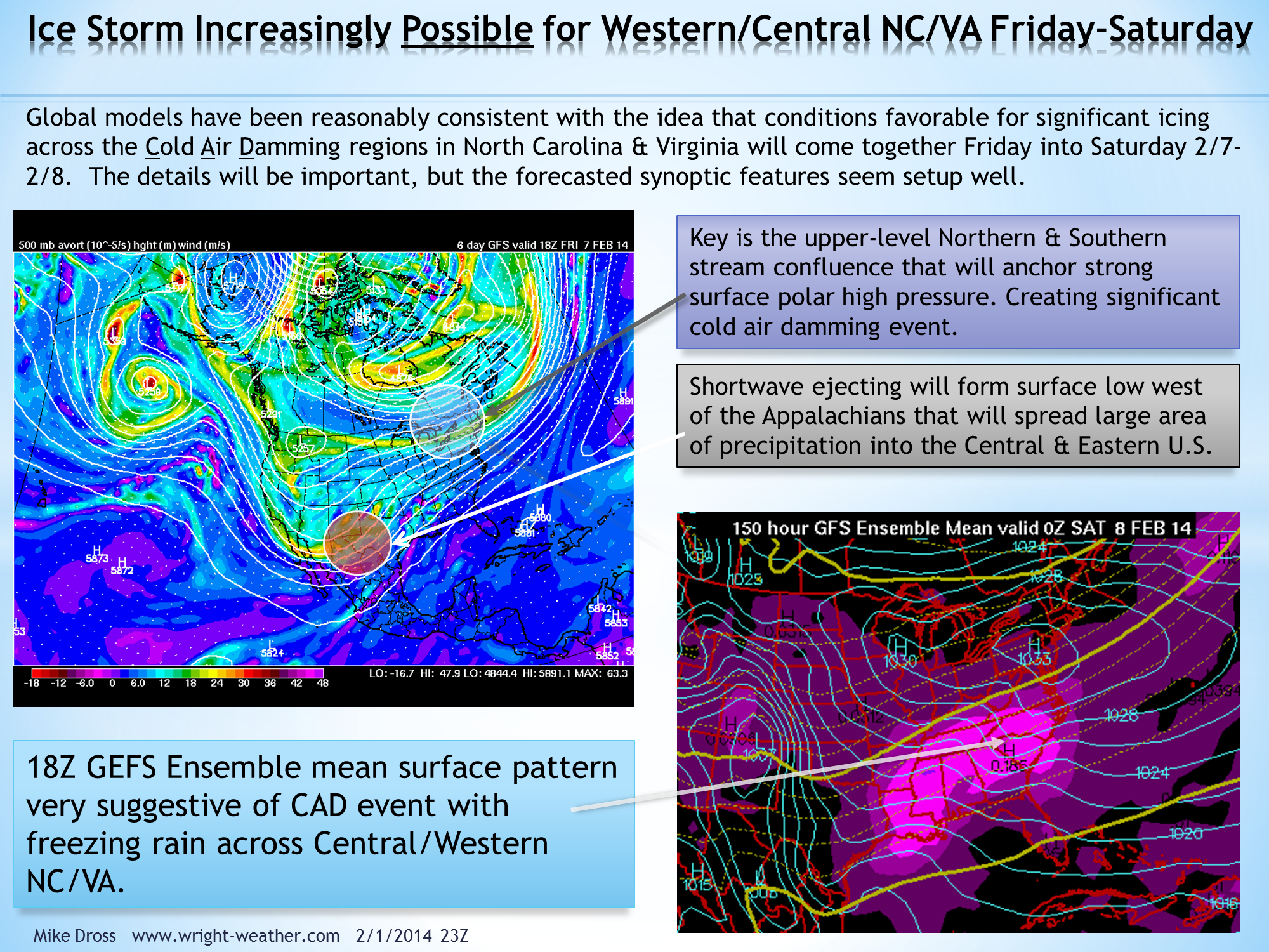
Updated: Ice Storm Increasingly Possible for Western/Central NC/VA Friday/Saturday

Update:  2/4/2014 03:00Z

Models have trended originally from a Miller B system to a strong Miller A system yesterday that brought heavy winter precipitation up the east coast from NC to Maine.

Today the models have largely backed away from any inland development and any phasing would take place off-shore and on Sunday.  The pattern I outlined below, I wrote about 3 days ago,  is not expected to materialize as the models had alluded it might.  The confluence area across the Eastern North America does not look like it will be very strong and the short wave coming into the U.S. is likely to be somewhat weaker than earlier projected and will not dig into the Southwestern U.S.

The end result is a much different scenario, with little or no cold air damming and possibly no precipitation.
2/1/14 23:30Z

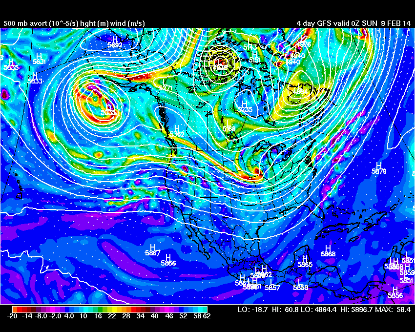
The ECMWF and GFS deterministic & ensembles have been supportive of the synoptic setup that is favorable for a wintery, cold air damming event across NC/VA the end of next week with a mixture of precipitation, though predominantly freezing rain or sleet.

Having forecasted these types of events for many years as an operational meteorologist for Duke Energy, I had to often look for synoptic clues many days out rather than relying on explicit model output of things like 2 meter temperatures or precipitation type values that would indicate a significant icing event.

Models generally do not handle very cold air at low levels,  particularly well. Especially the global models as they have a smaller number of vertical levels near the boundary layer where a lot of the shallow very cold air exist with arctic air masses.  The global ensemble models have even less vertical levels than the deterministic models making them often  poorer choices for depicting things such as cold air damming events.

So while we are some 6-7 days from this potential event, there has been a consistent theme among the global models that makes me believe that a growing risk exist of winter weather and potentially a significant amount of freezing rain Friday into Saturday.

Historically, one of the primary mechanisms we have observed in NC that accompany significant icing events, is an upper level confluent flow across the Northeast or Eastern Canada that is maintained though much of an event.  This causes surfaces pressures to remain high and re-enforces cold air at low-levels down the Piedmont of Virginia & North Carolina.   Future model runs will need to be monitored to see if this trend is maintained.