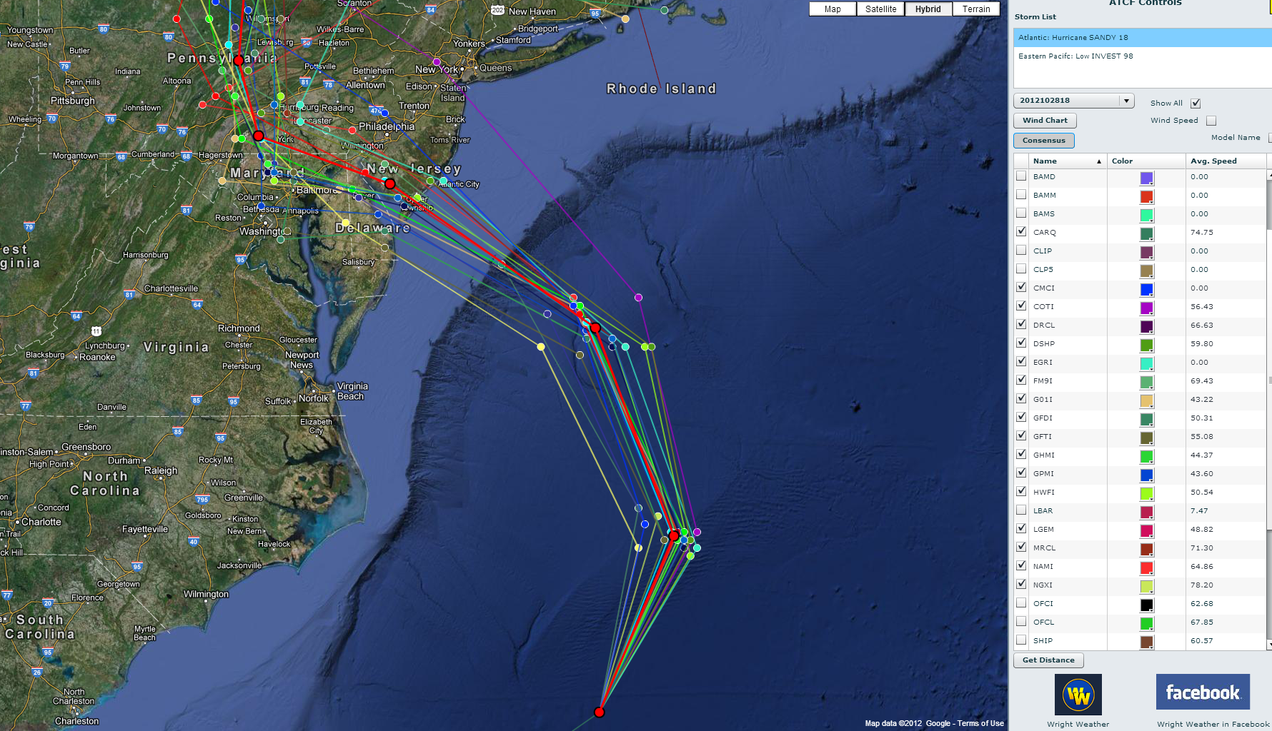
Latest 18Z track model guidance continues to remain tightly clustered around a landfall location in New Jersey. The 12Z ECMWF is very consistent with its previous runs and the GFS. Below is the spread and the mean (consensus) forecast tracks from the 12Z dynamic models / 18Z statistical models.
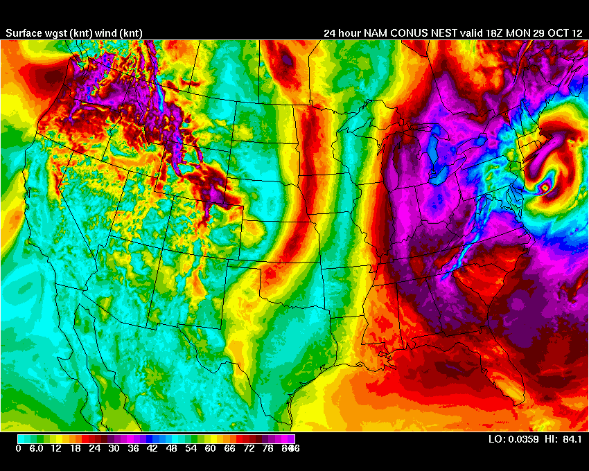
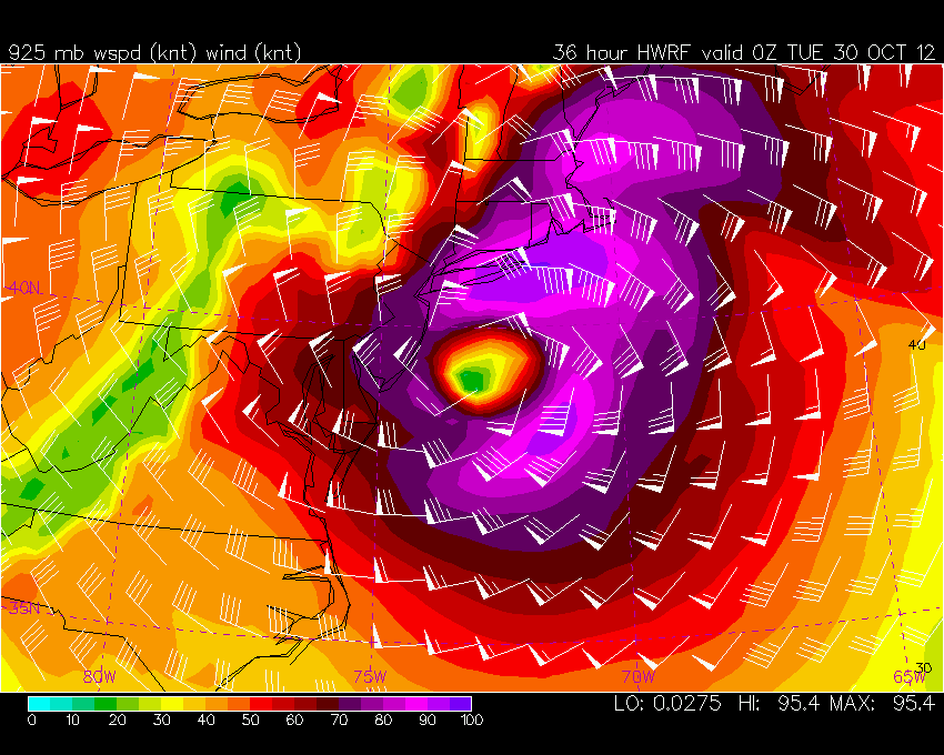
The mesoscale models are in good agreement of a low level wind max from 900-800 millibars around 100-110 knts that will move inland as Sandy approaches the coast. The NAM 4km nest is forecasting surface gusts in the 80 knot range over open water which seems reasonable. Generally a 90% reduction is used in warm core eyewall from 850 millibars, to estimate surface wind speeds (10 meters). But since this system will not have very much deep convection, that will likely be too generous. My feeling is that much of the wind at 900mb will remain aloft due to the lack of deep convection, but occasional gusts will make it to the surface in some of the heavier showers that will rotate around the center of the cyclone. If the models verify with the 850mb wind forecasts then it seems almost certain that surface wind speeds will exceed 70 mph in gusts. Also, based on the NAM 4km it appears very strong gusts may occur much further north, near Boston. On the order of 60-70 mph near the coast.
Below are two images. The first is the latest track forecast. The second is the 4km WRF Wind Gust Forecast. Note the fetch of 70+ wind gust from Nantucket to the New Jersey Coast.
Click this link for the 36 hour animation of the surface wind gust forecast


