Severe Weather Outbreak Likely Friday Afternoon/Night Midwest – Southern Plains
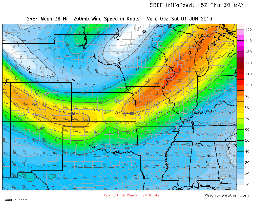
As an upper level low begins to move eastward, the strong core of the mid and upper level winds will rotate around the upper low. An increasingly favorable kinematic environment for supercells and potentially strong tornadoes will develop from Central Illinois/Central Indiana through Southern Missouri into Eastern/Central Oklahoma and Northern/Western Arkansas.
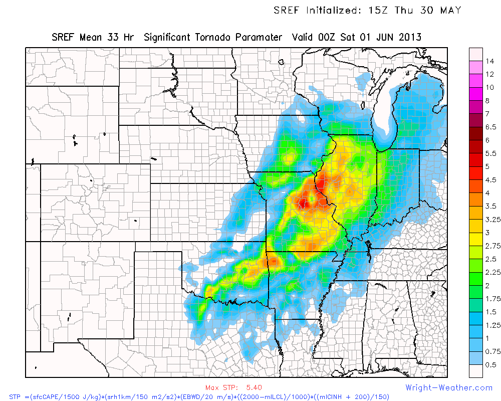
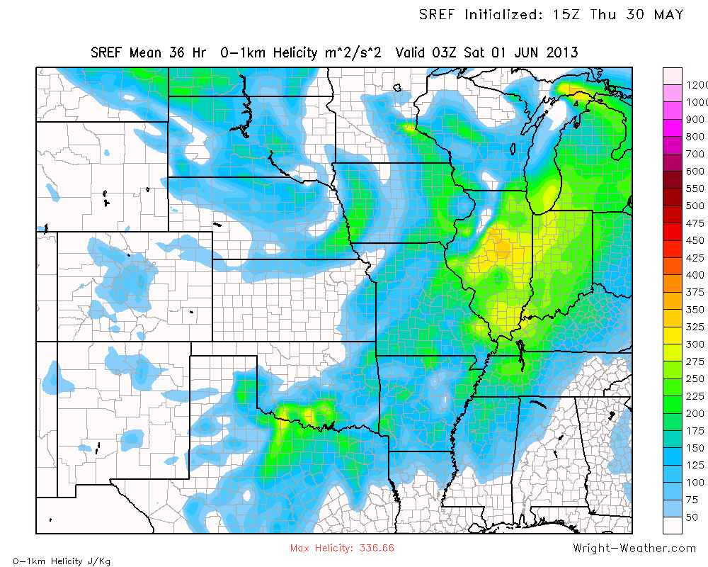
The area at greatest risk for strong tornadoes is from Central/Eastern Oklahoma through Southern Missouri into Central Illinois. Although there will likely be AM storms, some severe, the storms that will develop Friday afternoon and move into Ohio-Valley during the overnight hours are the ones that pose the greatest risk for that area. Boundaries from earlier convection in the day will likely focus localized helicities values over 400 m^2^s which will enhance the tornado potential with storms that develop in non-linear modes. Bulk Richardson Shear values favor supercell storm modes across these areas, at least initially.
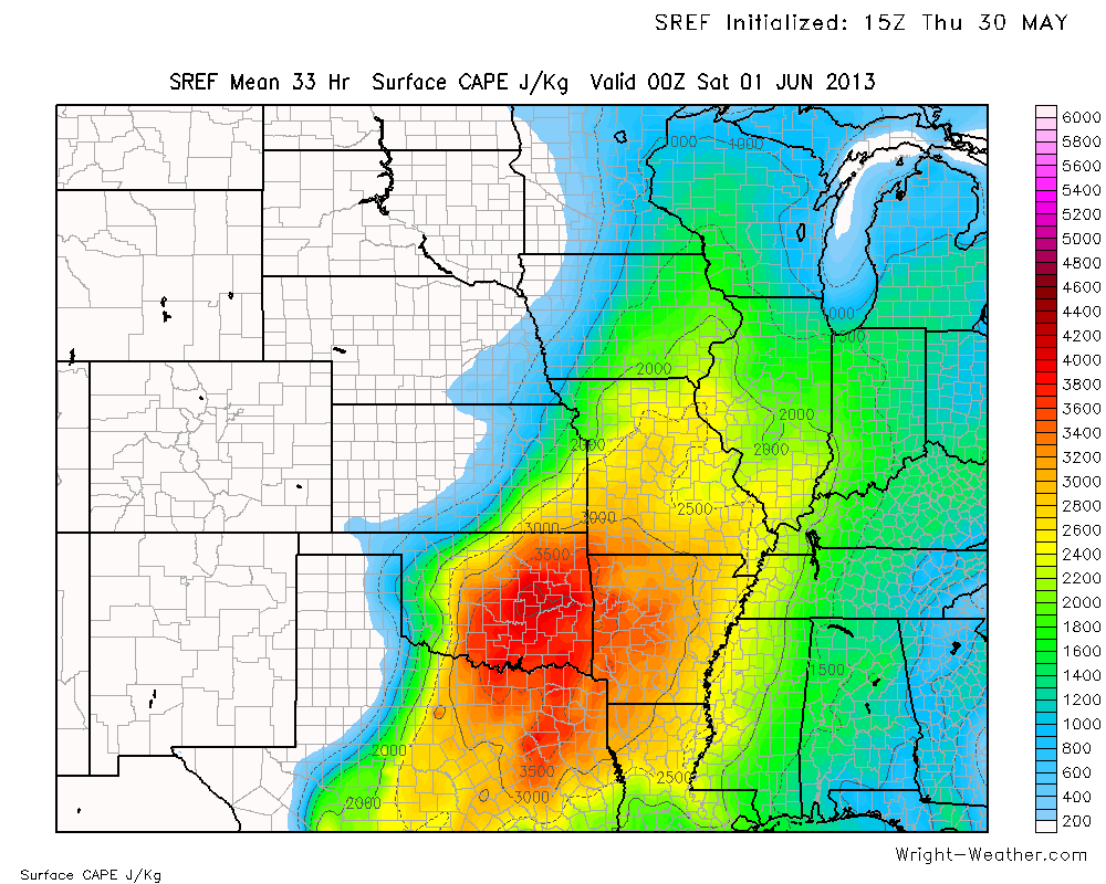
Other storms will likely form further south across Oklahoma where the instability will become extreme with surface capes over 5000 and shear values in excess of 40kts. CIN will drop below 25 j/kg by afternoon and supercells should form with the aid of an approaching shortwave. With LCL’s AOB 1000 meters, tornadoes are quite likely, especially across Northeastern OK.
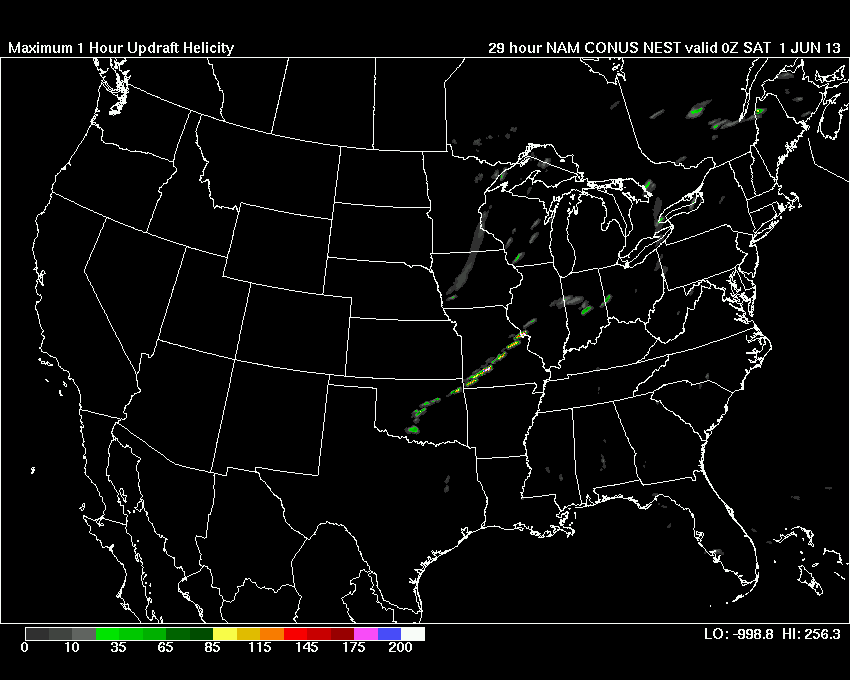
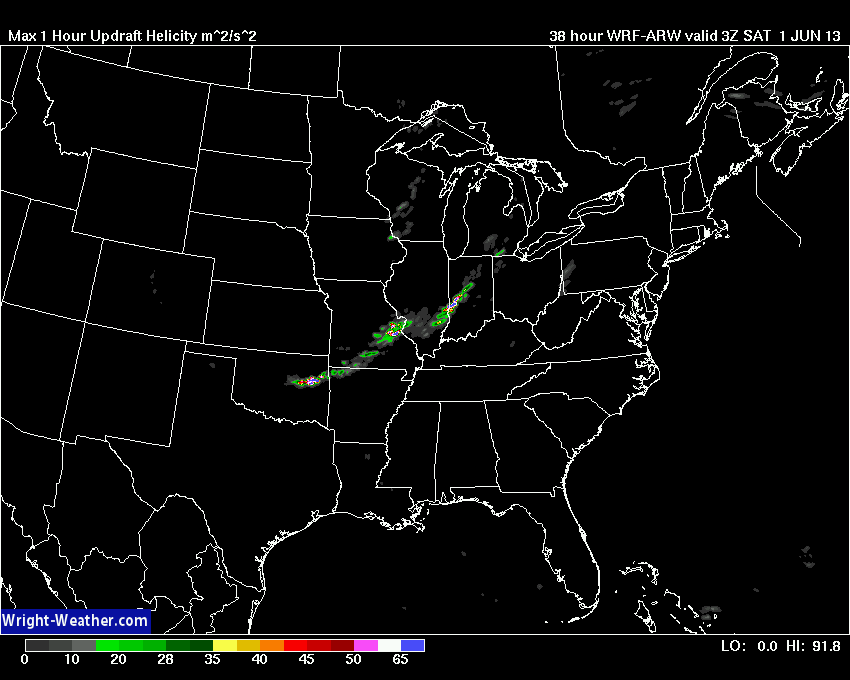
The Maximum Updraft Helicity product from the 4km WRF/ARW has been consistently generating strong supercells across OK, MO, IL Friday Afternoon & Evening.
1 Hour Max Updraft Helicity. Indicate Rotating storms develop late.
Max 1 Hour Updraft Helicity from WRF-ARW
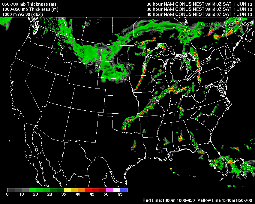
WRF-4KM Simulated Radar 23Z Friday
0-6 KM Shear Increase as Mid-Level Jet Works into the Region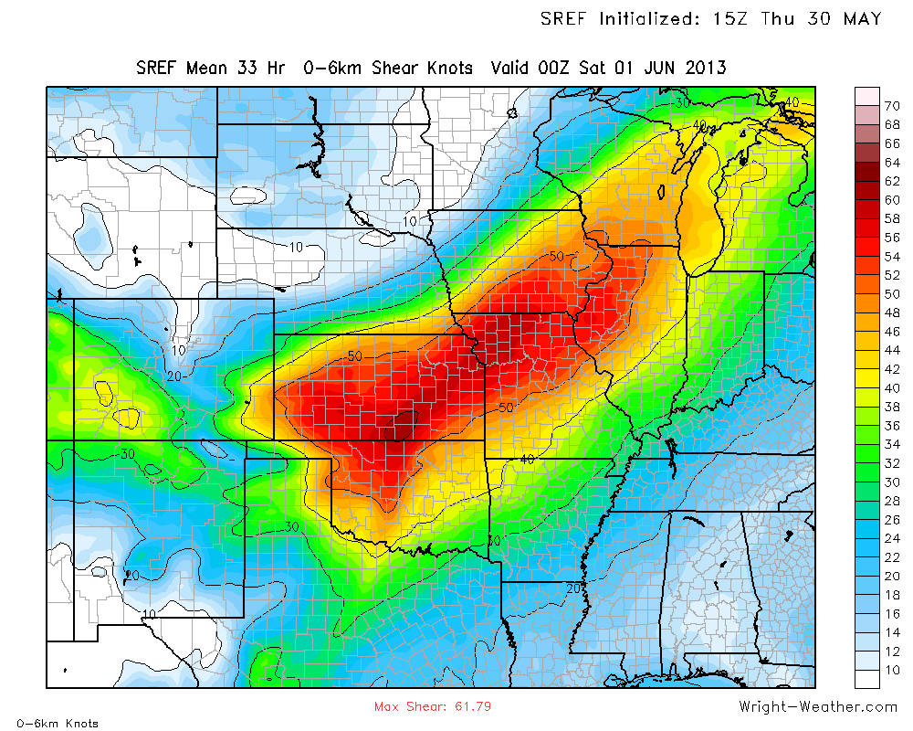
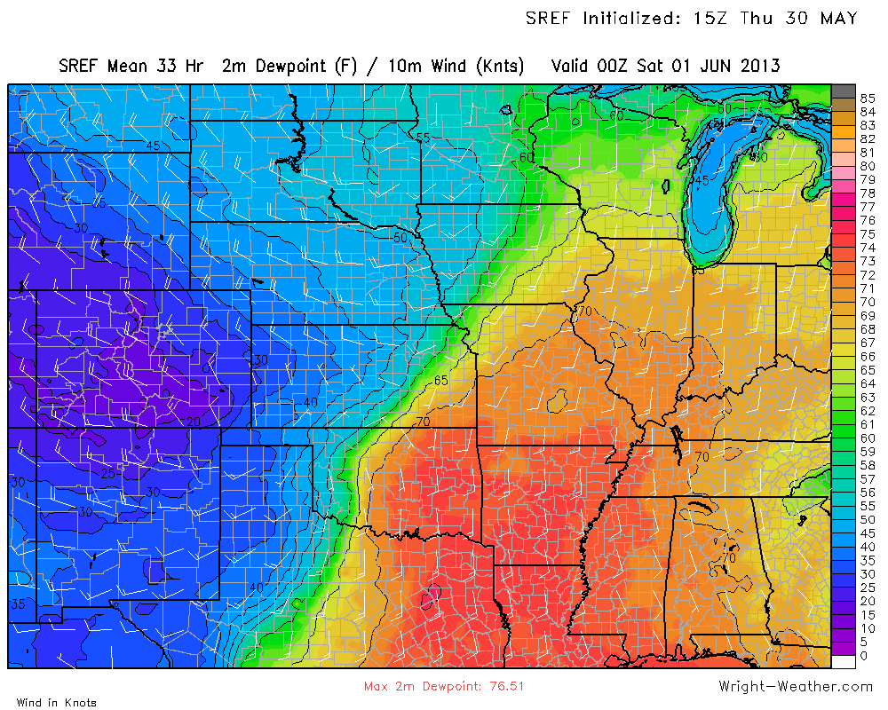
High Surface Dewpoints work northward into IL/IN feeding storms.
Surface CAPE is quite high.
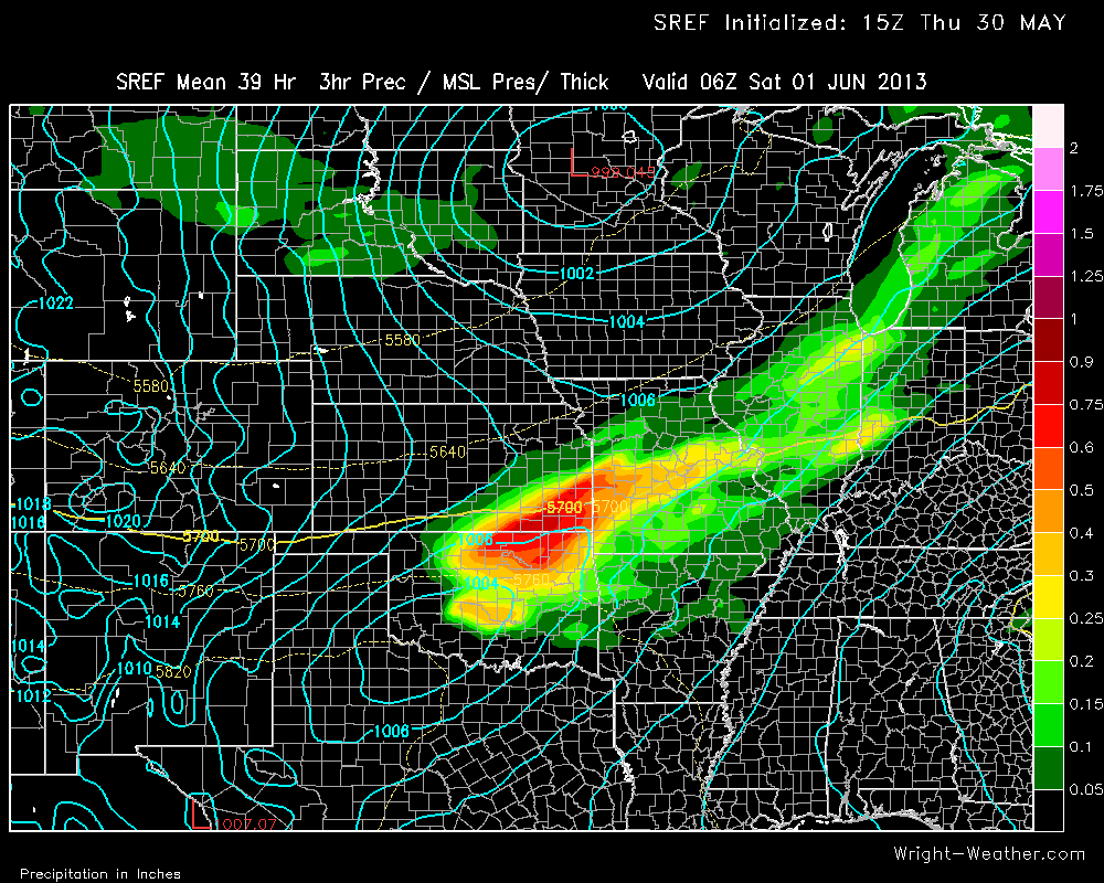
Surface Low over MN and Secondary Low over SW OK will help back Low Level Winds.
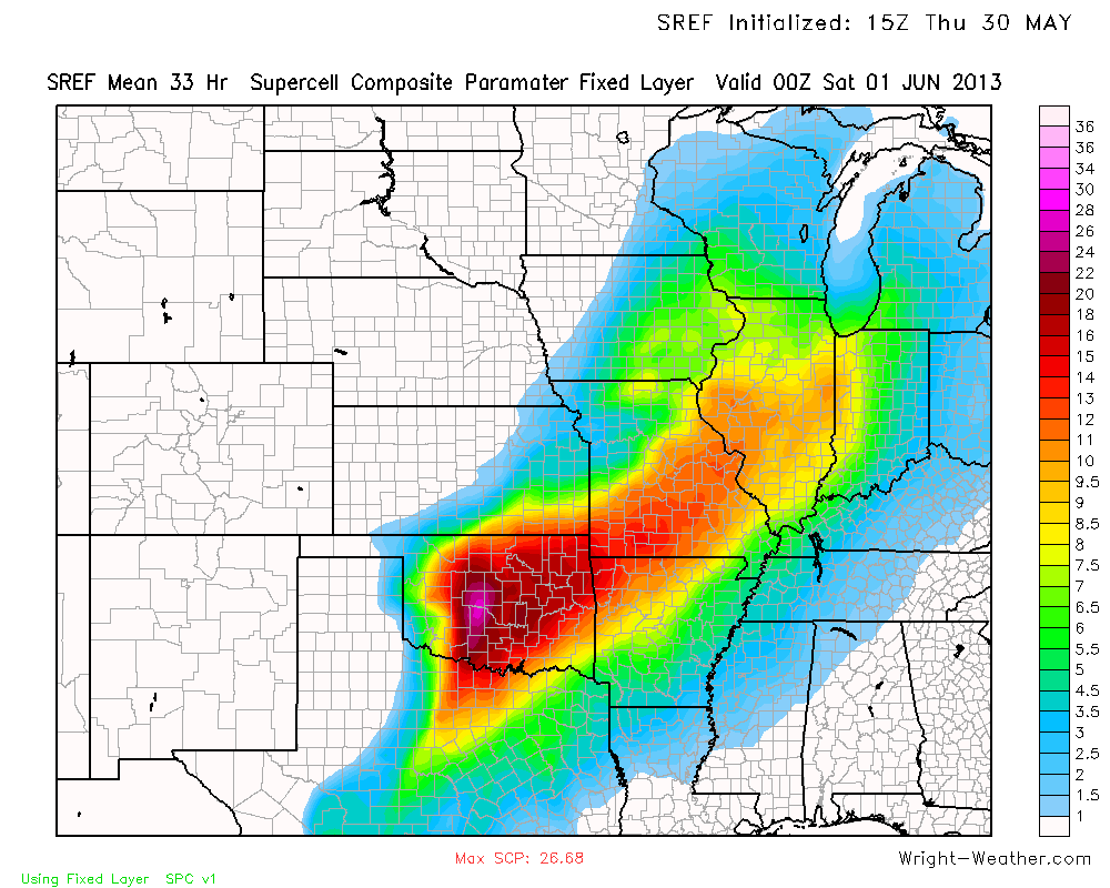
Supercell Composite Parameter indicates likelihood of rotating storms from OK northeastward into IL.
Significant Tornado Parameter indicates risk of strong tornadoes.
0-1km Helicity 03Z
250mb RRQ of Jet will enhance Vertical Motion
Upper Level Low will move Eastward with cold pool and wind max
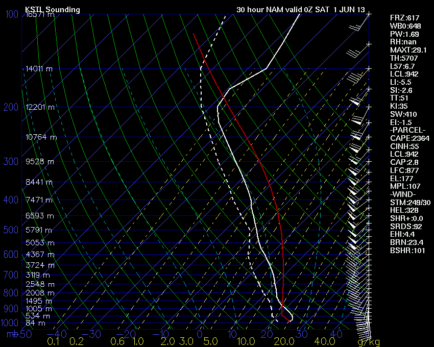
St. Louis, MO Forecast Sounding for Friday Evening. Small Cap, but supportive of Supercells and possible tornadoes
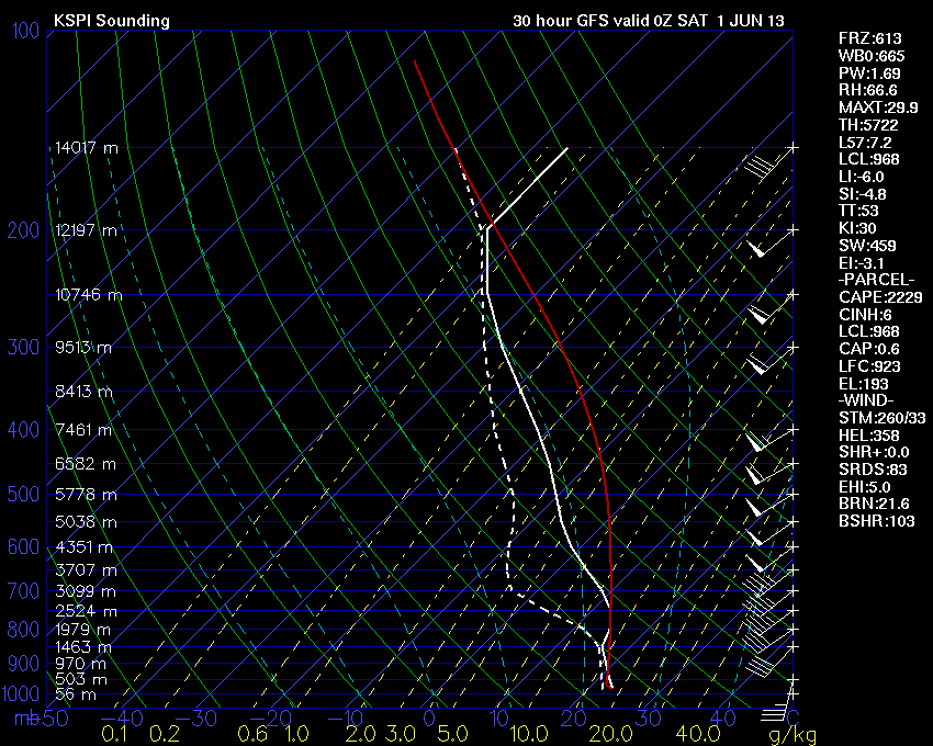
GFS Forecast Sounding for Springfield, IL for 00Z. Again kinematics and thermodynamics supportive of supercells and tornadoes.
Extreme Instability at Oklahoma City per the GFS Forecast Sounding
-Mike Dross


