GFS Upgrade v16 Scheduled for March 17th


** GFS Upgrade has been completed **

NCEP/NOAA is scheduling the GFS to be upgraded on/about March 17th.   We do not expect any significant issues migrating from the current operational version to the new version, however there  may be some delays or minor issues during the changeover.

The new version of the GFS provides higher vertical resolution with more layers added above the tropopause, the horizontal resolution remains the same.  Numerous changes have been made which will cause the GFS output being about 20 minutes slower than the current operational version, while consuming about 4x the amount of supercomputing processing power.

Having reviewed the statistical skill scores of the GFSv16  there is very slight improvement, but there were some negatives, such a significant right bias in tropical cyclone tracks and a much lower CAPE value then the previous GFS, which was already negatively biased.

So be aware of these items when using the new GFS.  CAPE values will tend to be suppressed, which will make other severe convective parameters appear less intense (SCP,STP,EHI) and Tropical cyclones forecast skill was not improved ( GFS v16 to GFS v15), as noted in the active 2020 season.

Here is the GFSv16 Evaluation Page:
https://www.emc.ncep.noaa.gov/users/meg/gfsv16/
Here is the Service Change Notice:
https://www.weather.gov/media/notification/pdf2/scn21-20gfs_v16.0.pdf

Unusually High Risk of Tornadoes With Hermaine Landfall Across Coastal Georgia & South Carolina Friday

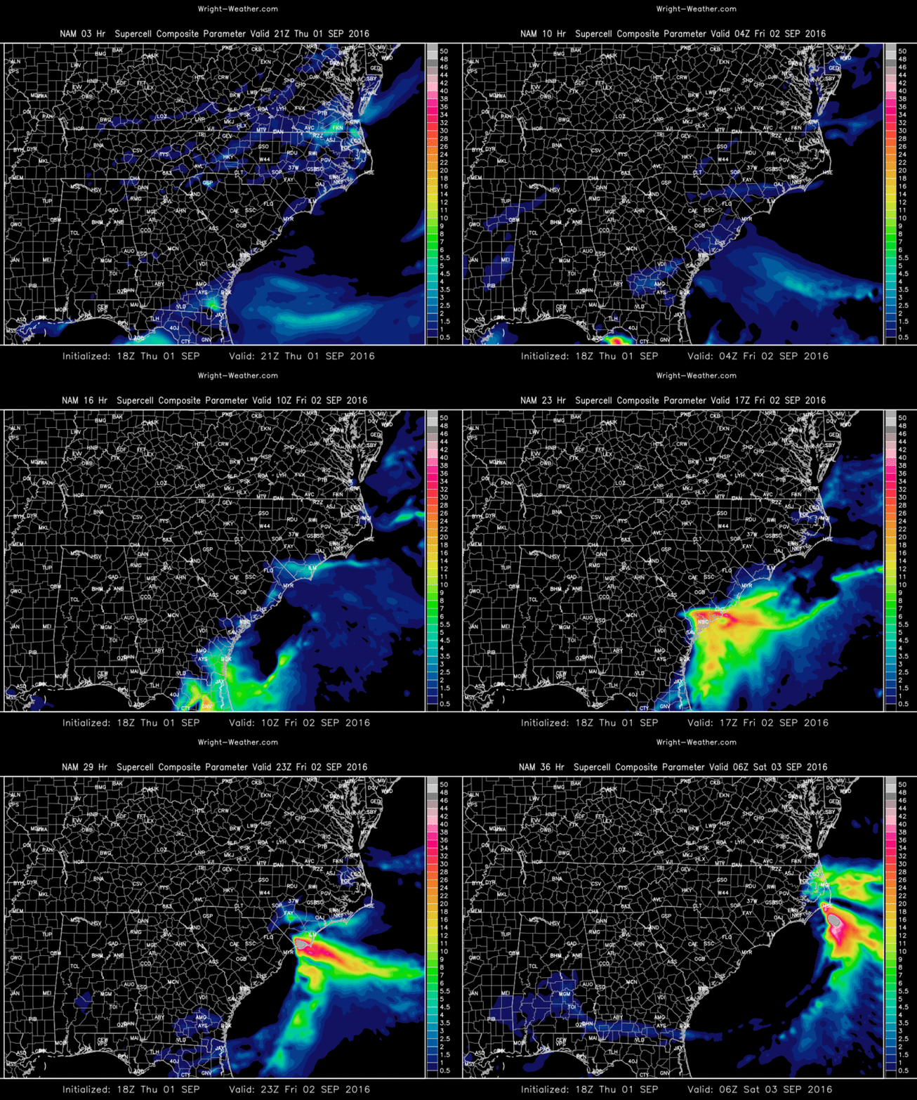
Hurricane Hermaine will make landfall in the Florida Panhandle tonight and then likely track up the coastal plain of Georgia into the Carolina’s on Friday. Seldom seen, with a tropical system, a mix of highly unstable air off the Atlantic ocean interfaced with extreme shear/helicity over Southeastern Georgia and Eastern South Carolina may combine to produce a number of mini-supercells and tornadoes, some that are stronger than what is typical with tropical cyclones. A highly localized outbreak of tornadic supercells across the Coastal Plain of Georgia and South Carolina is possible.

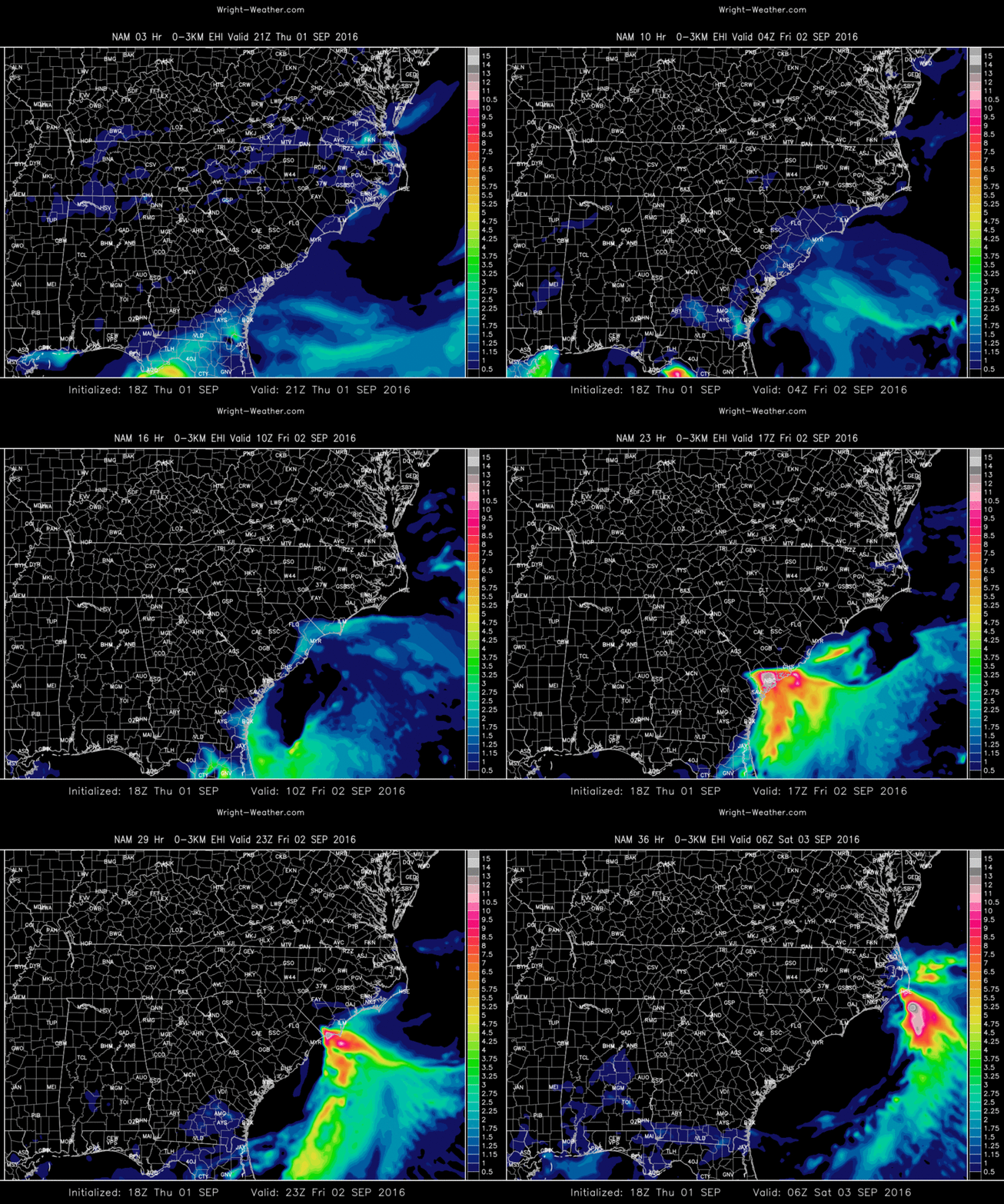
CAPE values from a number of models suggest a plume of instability will be entrained into the tropical cyclone from the Atlantic westward, coincide with the area of maximum low level helicity near the Georgia/South Carolina Coast Friday. This will be highly dependent on the exact track of the center.

In many tornadic episodes with tropical cyclones, CAPE values can be typically be in the 400-800 J/Kg range, rarely seen above 1500 due to clouds and warm temperatures aloft.

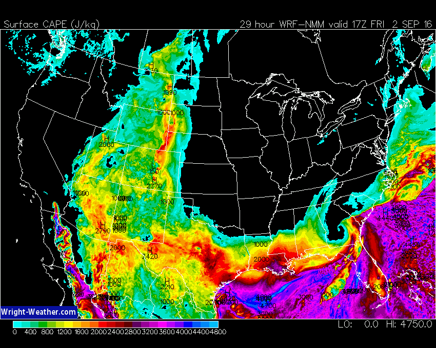
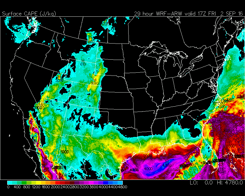
Model simulations from the ECMWF, NAM, NAM-4KM, WRF-NMM, WRF-ARW suggest CAPE values as high as 3000 J/Kg along the South Carolina and Georgia Coastal areas Friday afternoon.

If this materializes, as the models are simulating, an extreme environment is being created across this region where strong to even violent tornadoes could occur.

Forecasters  should pay very close attention to this area, because this is atypical for the type of CAPE/Shear relationship you typically find with a land falling tropical system.

Here are some plots of the 12Z/18Z models for tomorrow highlighting the threat.

Extreme CAPE Values mixed with the TC wind-field potenitally


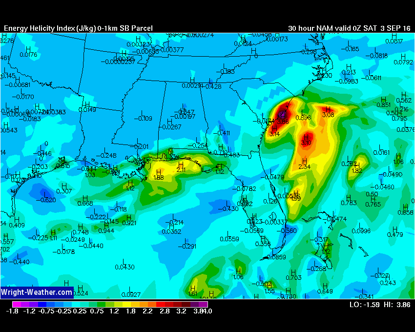
Very high values of 0-1km EHI for a tropical system

Very high Surface CAPE near the Coastal Plain


Very high Supercell Potential. Typical tropical system do not have high SCP due to low CAPE.

Again Very High Significant Tornado Potential, which is uncommon for land-falling tropical systems.

HRRR & RAP Models Upgraded Today

The HRRR and RAP Models were both upgraded today.  Many changes to the internal physics where introduced which should improve the forecast accuracy of both models.

More details can be found here in a technical notice from NCEP.

http://www.nws.noaa.gov/om/notification/tin16-26rap_hrrrr.htm

The HRRR model was increased to 18 hours on the Wright-Weather site.
The RAP model will be increased to 21 hours from 18 hours later this week.

http://hrrr.wright-weather.com/hrrr.php


HWRF Upgraded for 2016. Invest 97L Available

NCEP has significantly upgraded the HWRF this year in time for the heart of the 2016 tropical season.

I have updated the code to process the new higher resolution HWRF data which is double the resolution of the older model output.

Invest 97L is now available along with other systems being monitored in the Atlantic and Pacific Oceans.

Check the Tropical Products menu on the home page, under “Site Navigation” for the name of the tropical system with word HWRF appended to it.

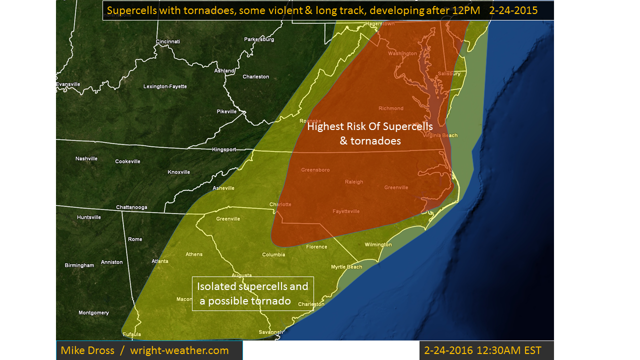
Outbreak of Supercells & Tornadoes from North Carolina Northward into Maryland This Afternoon

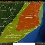
Conditions favorable for supercells and tornadoes this afternoon will develop across Central and Eastern North Carolina into Western Virginia.  Extremely favorable shear and strong mid-level winds will combine with afternoon heating, to allow destabilization to occur at the time of frontal passage. A broken line of supercells should form by mid to late afternoon across Central North Carolina northward into Western Virginia, These cells will move rapidly northeastward beneath a 100+ knt mid-level jet.   The cells will be capable of producing violent tornadoes as they continue into the evening hours. Straight line winds of 75 mph are also possible in bowing segments or in rear flank down drafts.  There will be a considerable amount of dry air aloft which will limit the coverage of storms, but will aid the formation of the tornadoes, combined with a low lcl.


Severe Weather & Tornado Outbreak Increasingly Likely Saturday From The Lower Ohio Valleys into Mid South

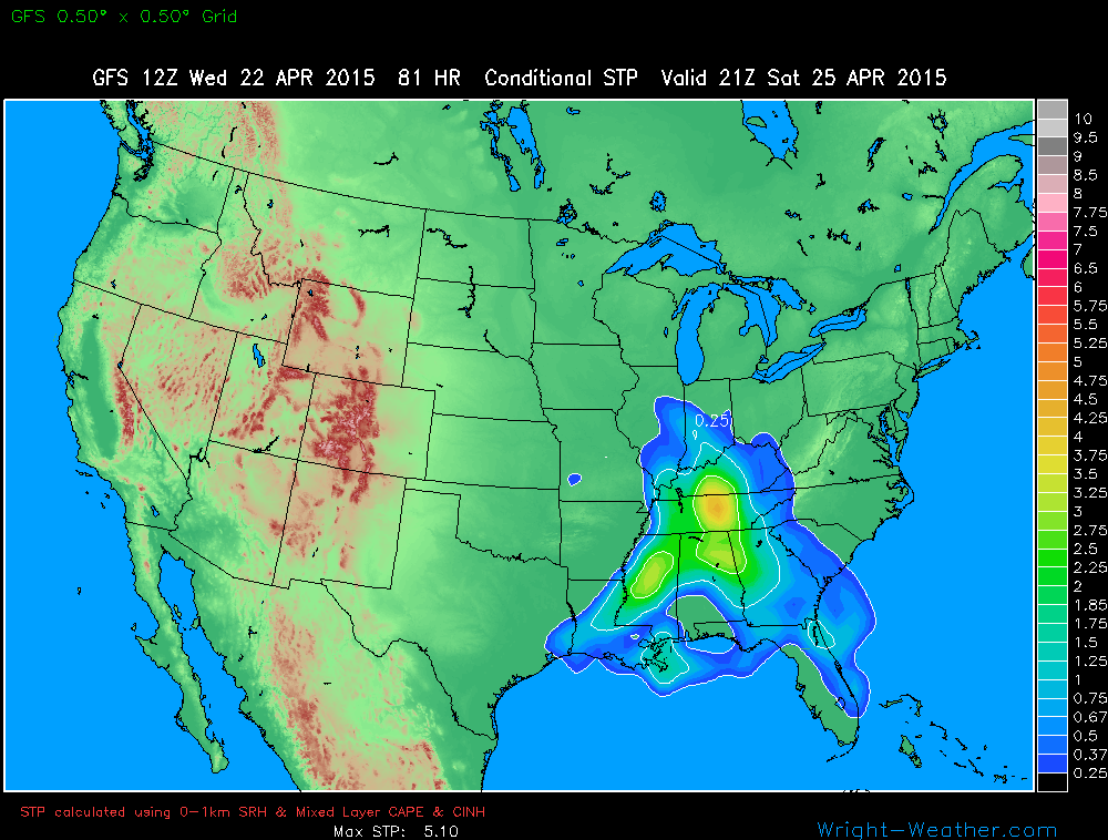
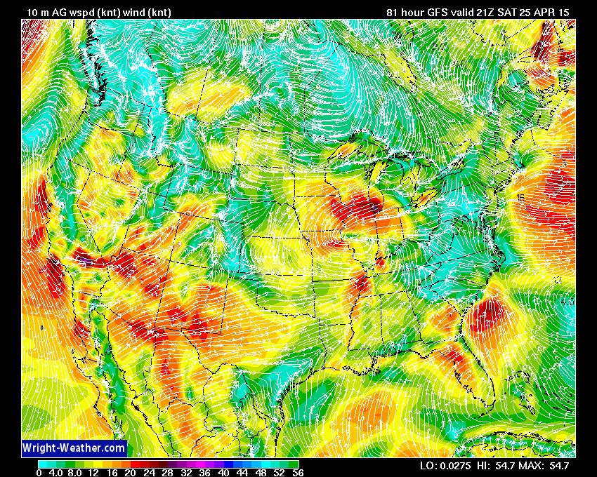
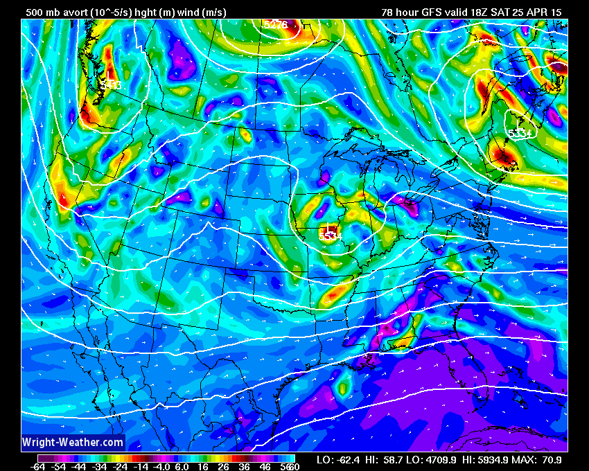
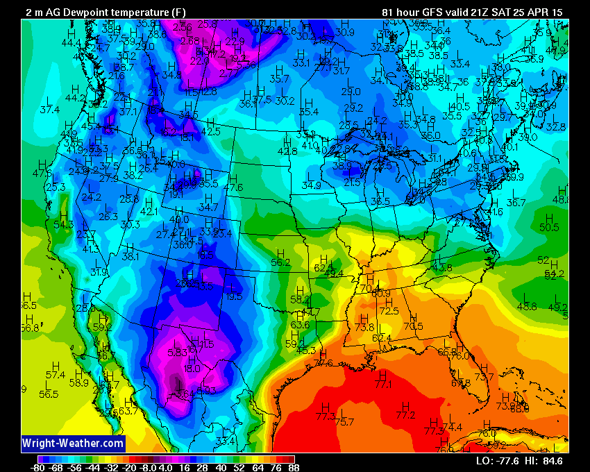
A potent mix of thermodynamic and kinetic forces will become colocated across the lower Ohio and Tennessee Valleys on Saturday to create conditions favorable for destructive, powerful supercells and potentially violent tornadoes.

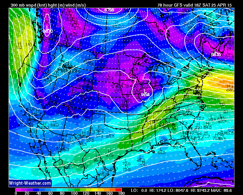
A very powerful jet stream will work across this very unstable airmass with winds at the 200mb level in excess of 150 mph, as depicted by the NWP guidance. It is very rare to have winds of this strength/a jet stream/ directly across the convective layer and will add significantly deep layer shear aiding in ageostrophic imbalances helping to promote mesoscale ascent.  Typically, the mid latitude jet is well removed of the warm/buoyant air mass and rarely directly overlaps.  This could be one of the more unique events and we need to watch this very closely given the kinetic forcing in the upper levels of the troposphere in this upcoming event.

Guidance at this time suggests an early round of showers and non-severe thunderstorms will move through the Mid-South during the early morning hours, followed by partial mid-day clearing allowing for solar insolation and destabilization in the Ohio, Tennessee-Valleys. How these lead convective elements ultimately play out will likely define mesoscale outflow boundaries that will determine where supercells and tornadoes develop later in the day.

This midday-afternoon destabilization combined with a rapidly strengthening wind field at all levels will increase the severe weather risk as a strong upper level (300-200 mb) jet streak punches into the region during the afternoon with a jet wind maximum of nearly 150+ mph closely collocated with the storms

Convection with supercells and the risk for strong to violent tornadoes will develop in association with this powerful  jet/shortwave from the Ohio-Valley southward into Mississippi/Alabama and spread eastward.

The area at highest risk of tornadoes appears to me from Southern Illinois, Southern Indiana,  across Kentucky, Tennessee southward into Central Mississippi and Alabama.  The strongest tornadoes would likely occur in Southern Illinois, Southern Indiana, Kentucky and Tennessee closest to the best 0-1km shear maximum, 0-1km SRH and lowest LCL’s. The tornado risk may spread into western Georgia.

Forecasters and those living in these regions should closely monitor developments and SPC outlooks over the next few days.

On to the maps….


Numerous Severe Thunderstorms Expected Across the Ohio-Valley Wednesday Afternoon & Evening

A slow moving cold front across the lower Great Lakes will provide the low level convergence, combined with favorable instability & shear to ignite numerous severe thunderstorms Wednesday afternoon across the Ohio-Valley. Supercells will be a likely storm mode as bulk shear values will be in excess of 45 knots. In addition, 0-3km helicity values will be over 200, so there is a chance for an isolated tornado in the strongest supercells, although conditions are not ideal for tornado development.  Large hail and damaging winds are the primary hazards.  Supercells may evolve into a linear or bow echo configuration by late afternoon or evening.

Storms will likely diminish and weaken as they move east-southeastward into Central Kentucky Wednesday night where the low-level theta-e values will be significantly less, resulting in much less instability.

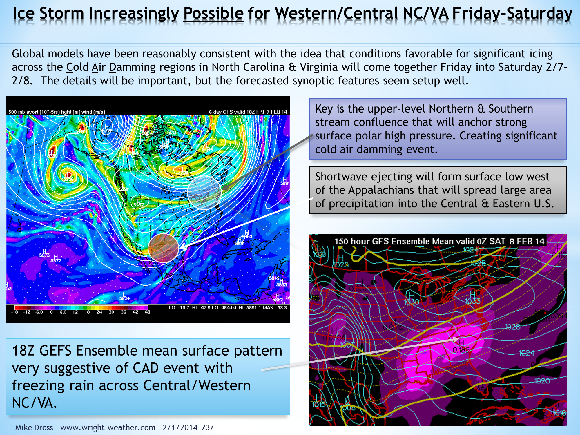
Updated: Ice Storm Increasingly Possible for Western/Central NC/VA Friday/Saturday

Update:  2/4/2014 03:00Z

Models have trended originally from a Miller B system to a strong Miller A system yesterday that brought heavy winter precipitation up the east coast from NC to Maine.

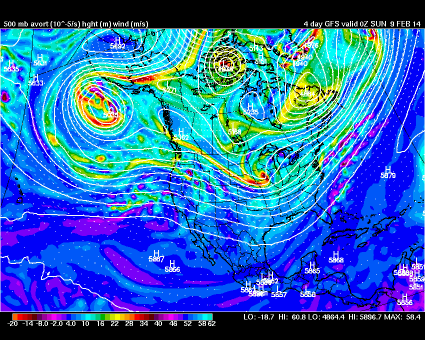
Today the models have largely backed away from any inland development and any phasing would take place off-shore and on Sunday.  The pattern I outlined below, I wrote about 3 days ago,  is not expected to materialize as the models had alluded it might.  The confluence area across the Eastern North America does not look like it will be very strong and the short wave coming into the U.S. is likely to be somewhat weaker than earlier projected and will not dig into the Southwestern U.S.

The end result is a much different scenario, with little or no cold air damming and possibly no precipitation.

2/1/14 23:30Z

The ECMWF and GFS deterministic & ensembles have been supportive of the synoptic setup that is favorable for a wintery, cold air damming event across NC/VA the end of next week with a mixture of precipitation, though predominantly freezing rain or sleet.

Having forecasted these types of events for many years as an operational meteorologist for Duke Energy, I had to often look for synoptic clues many days out rather than relying on explicit model output of things like 2 meter temperatures or precipitation type values that would indicate a significant icing event.

Models generally do not handle very cold air at low levels,  particularly well. Especially the global models as they have a smaller number of vertical levels near the boundary layer where a lot of the shallow very cold air exist with arctic air masses.  The global ensemble models have even less vertical levels than the deterministic models making them often  poorer choices for depicting things such as cold air damming events.

So while we are some 6-7 days from this potential event, there has been a consistent theme among the global models that makes me believe that a growing risk exist of winter weather and potentially a significant amount of freezing rain Friday into Saturday.

Historically, one of the primary mechanisms we have observed in NC that accompany significant icing events, is an upper level confluent flow across the Northeast or Eastern Canada that is maintained though much of an event.  This causes surfaces pressures to remain high and re-enforces cold air at low-levels down the Piedmont of Virginia & North Carolina.   Future model runs will need to be monitored to see if this trend is maintained.