Hurricane Hermaine will make landfall in the Florida Panhandle tonight and then likely track up the coastal plain of Georgia into the Carolina’s on Friday. Seldom seen, with a tropical system, a mix of highly unstable air off the Atlantic ocean interfaced with extreme shear/helicity over Southeastern Georgia and Eastern South Carolina may combine to produce a number of mini-supercells and tornadoes, some that are stronger than what is typical with tropical cyclones. A highly localized outbreak of tornadic supercells across the Coastal Plain of Georgia and South Carolina is possible.
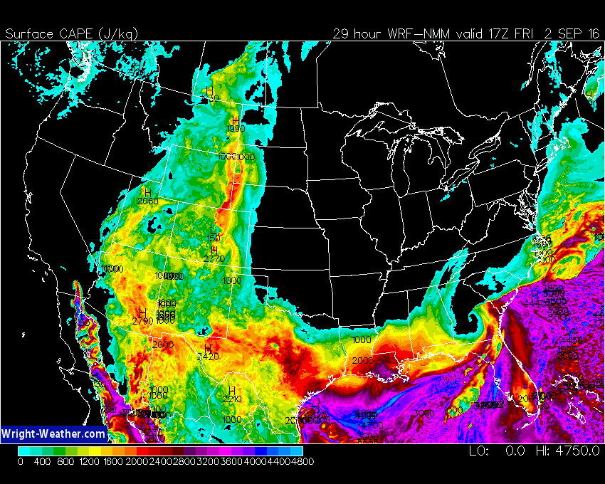
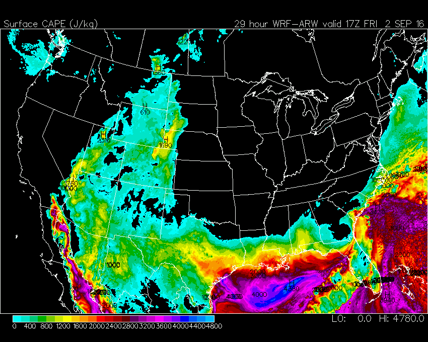
CAPE values from a number of models suggest a plume of instability will be entrained into the tropical cyclone from the Atlantic westward, coincide with the area of maximum low level helicity near the Georgia/South Carolina Coast Friday. This will be highly dependent on the exact track of the center.
In many tornadic episodes with tropical cyclones, CAPE values can be typically be in the 400-800 J/Kg range, rarely seen above 1500 due to clouds and warm temperatures aloft.
Model simulations from the ECMWF, NAM, NAM-4KM, WRF-NMM, WRF-ARW suggest CAPE values as high as 3000 J/Kg along the South Carolina and Georgia Coastal areas Friday afternoon.
If this materializes, as the models are simulating, an extreme environment is being created across this region where strong to even violent tornadoes could occur.
Forecasters should pay very close attention to this area, because this is atypical for the type of CAPE/Shear relationship you typically find with a land falling tropical system.
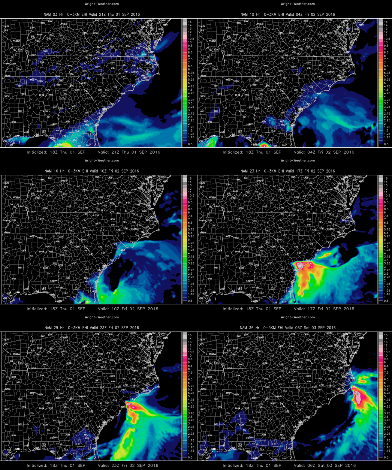
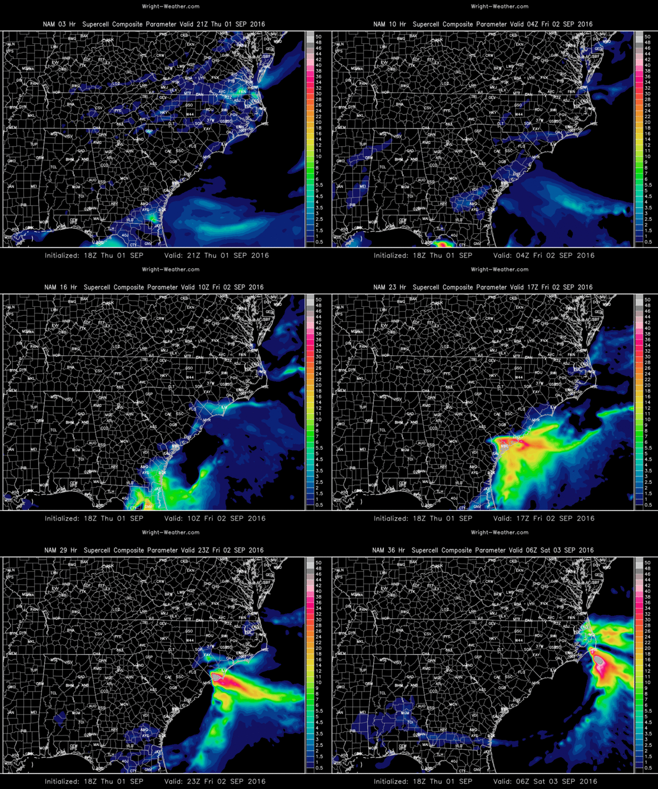
Here are some plots of the 12Z/18Z models for tomorrow highlighting the threat.
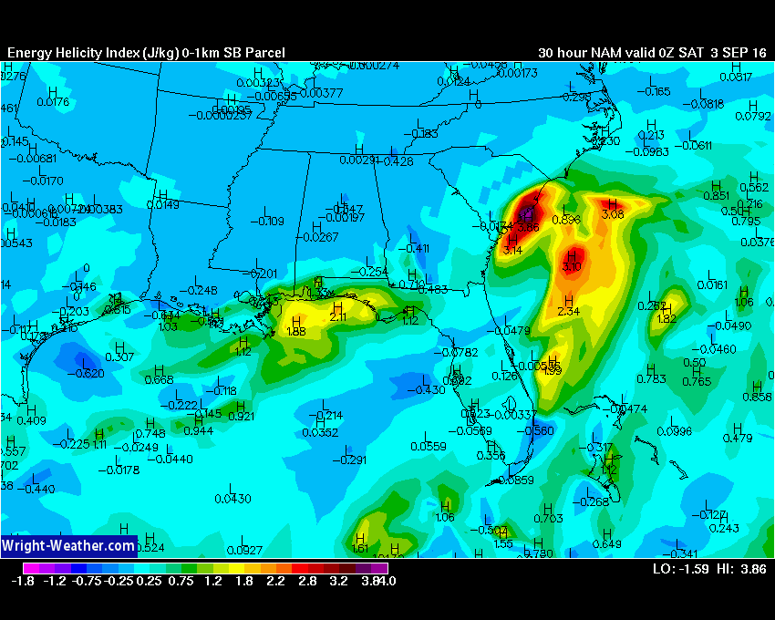
Very high values of 0-1km EHI for a tropical system


