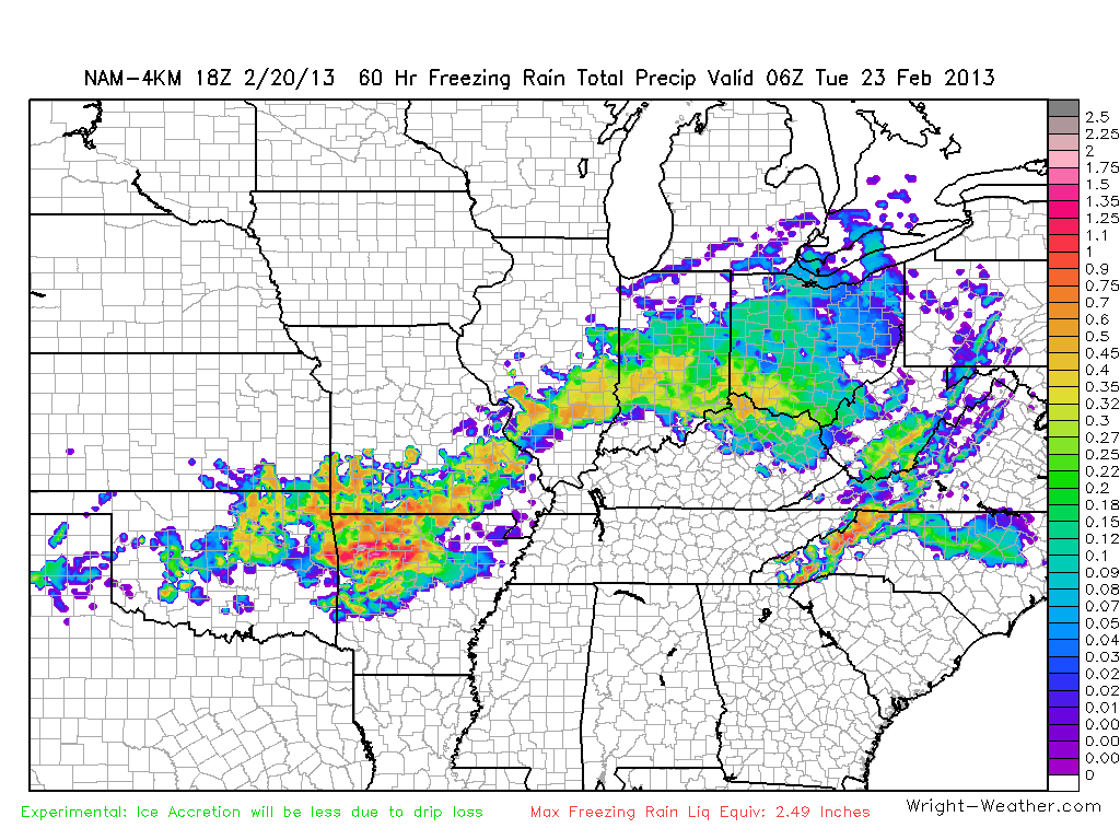
Freezing rain will be a big problem across Northern Arkansas and the data also suggest that Western NC may experience some buildup of ice. An experimental product we are working on in the Wright-Weather labs is a freezing rain accretion product. This is the 60 hour, pretty much direct model output, graphic from the NAM 4KM WRF-NMM. Keep in mind that actual ice accretion amounts will be less than the totals on this graphic. This is due to drip loss, that is freezing rain that drips off surface before freezing. Drip loss is highest when the temperature is closest to freezing and the precipitation rate is high.


