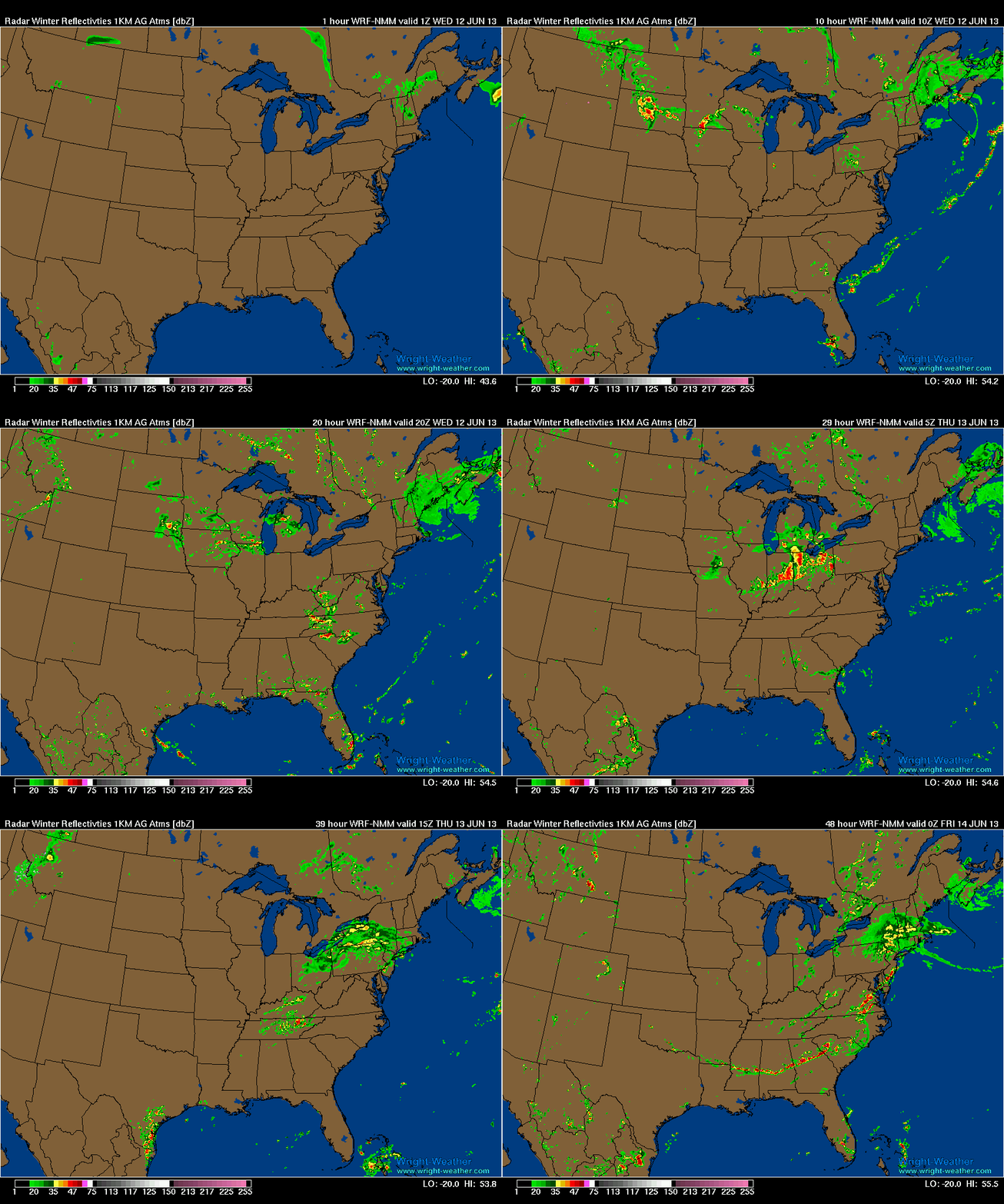
Complicated forecast for the Ohio-Valley into West Virginia and Western Pennsylvania, Wednesday into Thursday Morning. As indicated in last nights discussion, synoptic forcing is very strong and will create favorable conditions for a large area of severe weather as an intense low pressure for this time of year, moves across the Ohio Valley. The primary forecast problems are the convective mode that the storms take once they develop and whether the downstream ambient environment is contaminated by earlier convection that will disrupt the inflow and stabilize the boundary layer. This is exactly what happens with the WRF-NMM and WRF-ARW 4KM models, each a little bit differently. The WRF-4KM NAM CONUS Nest does not, and creates very little convective contamination prior to the main system arriving and develops a very dangerous environment across IL/IN/OH/ Western PA that would support a widespread severe weather event with supercells. While not explicitly, it would likely yield some tornadoes given the intense parameters it is generating.
Below are some animated GIF’s from the WRF-NMM to illustrate the forecast issue of convective contamination of the environment prior to the main forcing/convection related to the surface low. If this AM convection does not develop across WV/VA as indicated, the stable outflow may not be near as strong and may not provide the cool theta-e values and therefore not weaken the main convective system as much or at all when it arrives late Wednesday night.
WRF-NMM Radar Simulation. Note Convection that develops across WV/VA AM Hours Wed Morning.
WRF-NMM Note the Theta-e minimum associated with the AM convection across WV/VA mountains that works westward and helps weakens the approaching convective system late Wednesday night as it arrives in OH.
Even as it is, with some possible convective contamination. The mesocale models are generating some strong indications of a wide spread severe weather event.
Across the Ohio-Valley Wednesday into Wednesday night, the 0-1km helicity and the 0-6km shear will increase as the surface low deepens and the upper level shortwave approaches. Kinematic forcing will favor the formation of supercells and possibly tornadoes over a fairly large area, but the most favorable location will be just south of the stationary front/warm front which will maximize the 0-1km helicity.
Here is just one of the Updraft Helicity products from the various mesoscale models. This is from the WRF-NMM. It’s developing a long lived Supercell from just west of Chicago and tracking it southeastward. Other supercells develop across Indiana and Ohio. This is one of the longest and most intense updraft helicity values I have seen since observing these parameters.
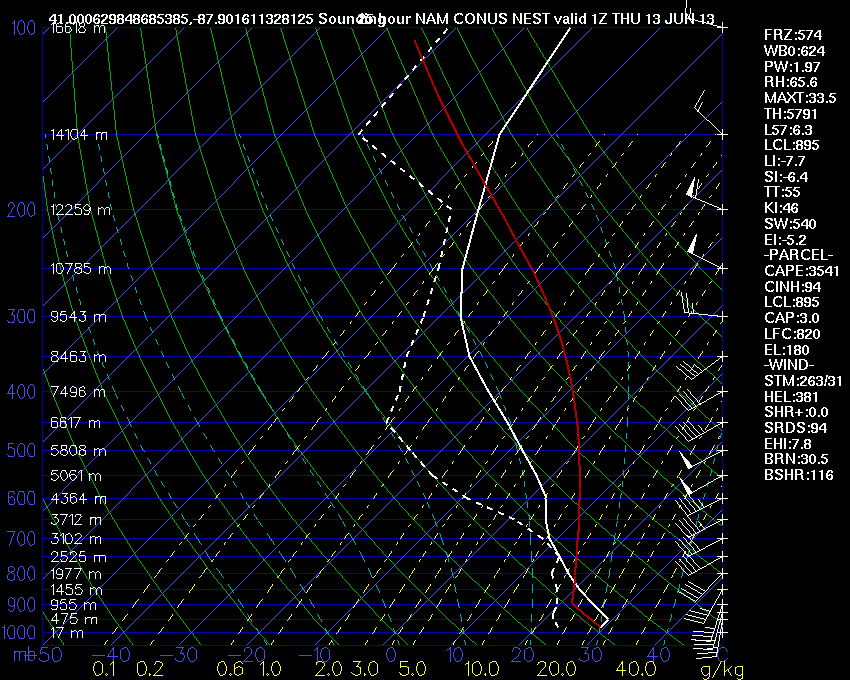
Forecast Sounding 40 Miles South of Chicago, IL 01Z Wednesday Evening. WRF-4KM NAM Nest
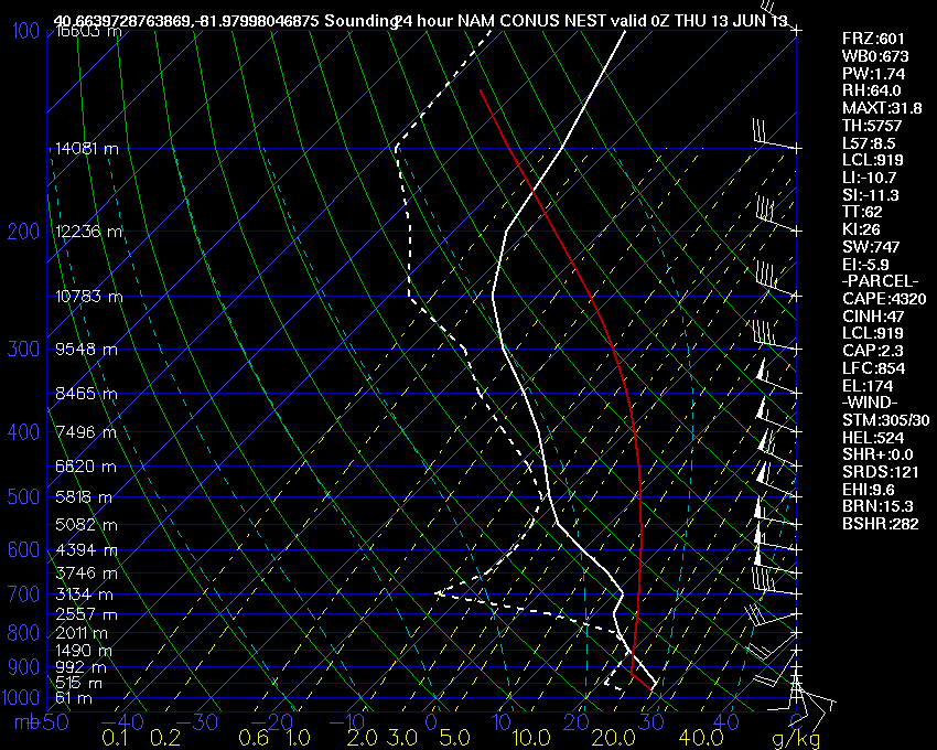
Forecast Sounding near Wooster, OH this evening at 00Z. Very Unstable atmosphere in place ahead of main forcing. Supercells and tornadoes are possible if convection can develop ahead of main convective system.
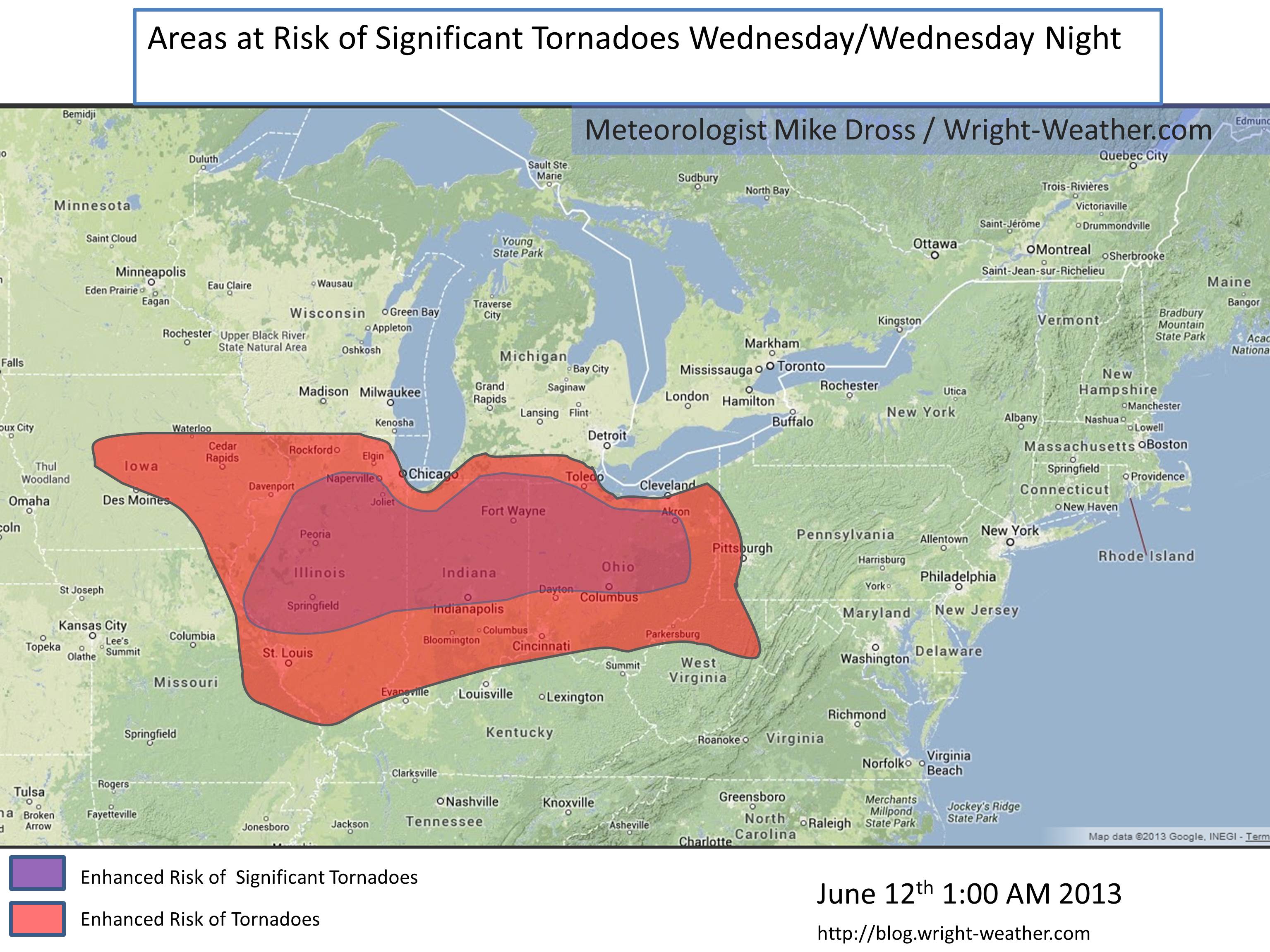
While the threat from widespread damaging wind is certainly high and linear mode convection may very well be the primary mode of convection for the duration of this event. I feel that there very well may be a period of time where there are either discrete supercells or embedded supercells with in a line. Given all the parameters, I believe the tornado risk is quite high along and just south of the stationary front from Central IL through IN into OH. This is a highly conditional forecast, since convective contamination from earlier storms may affect the environment or if the system becomes a large bow-echo or derecho very early in the evolution, then the tornado risk is greatly reduced.
Here is a map outlining the risk area of tornadoes based on all the available guidance through 05Z.


