Added ECMWF 500mb Winds

Added the ECMWF 500mb winds to the ECMWF regular resolution graphics. These can be useful in projecting the mid-level winds that can aid in organized severe thunderstorm development. These can be found in the drop down menu, as well as, the individual time frames. These are available for the Northern Hemisphere at the moment, but will include all sectors soon.

http://hp2.wright-weather.com/ecmwf.shtml

WRF ARW/NMMB Hires East are now being upgraded to CONUS sectors

NCEP has recently upgraded the WRF-ARW/NMM  Hires windows for the Eastern U.S.  to  a CONUS ARW and NMMB  ~4km  WRF runs.  They are run at 00Z and 12z and produce hourly output out to 48 hours at roughly 5km.

We are in the process of making the necessary changes within our software and systems to accommodate the increase in files sizes and processing requirements to handle the larger domains.  We should have these new data sets available and finalized later this week.  Look for them where the old WRF-ARW/WRF-NMM EAST model pages were located.

Here is the NCEP technical bulletin describing all the changes to the model & physics in the upgrade.

http://www.nws.noaa.gov/os/notification/tin14-16hiresw_aaa.txt

Numerous Severe Thunderstorms Expected Across the Ohio-Valley Wednesday Afternoon & Evening

A slow moving cold front across the lower Great Lakes will provide the low level convergence, combined with favorable instability & shear to ignite numerous severe thunderstorms Wednesday afternoon across the Ohio-Valley. Supercells will be a likely storm mode as bulk shear values will be in excess of 45 knots. In addition, 0-3km helicity values will be over 200, so there is a chance for an isolated tornado in the strongest supercells, although conditions are not ideal for tornado development.  Large hail and damaging winds are the primary hazards.  Supercells may evolve into a linear or bow echo configuration by late afternoon or evening.

Storms will likely diminish and weaken as they move east-southeastward into Central Kentucky Wednesday night where the low-level theta-e values will be significantly less, resulting in much less instability.

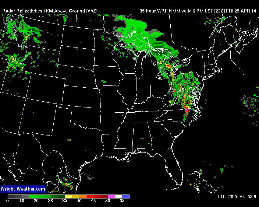
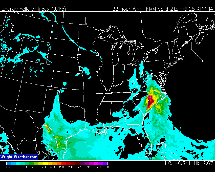
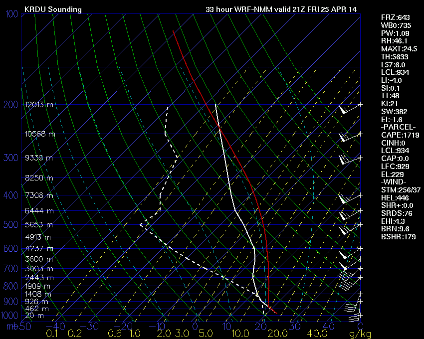
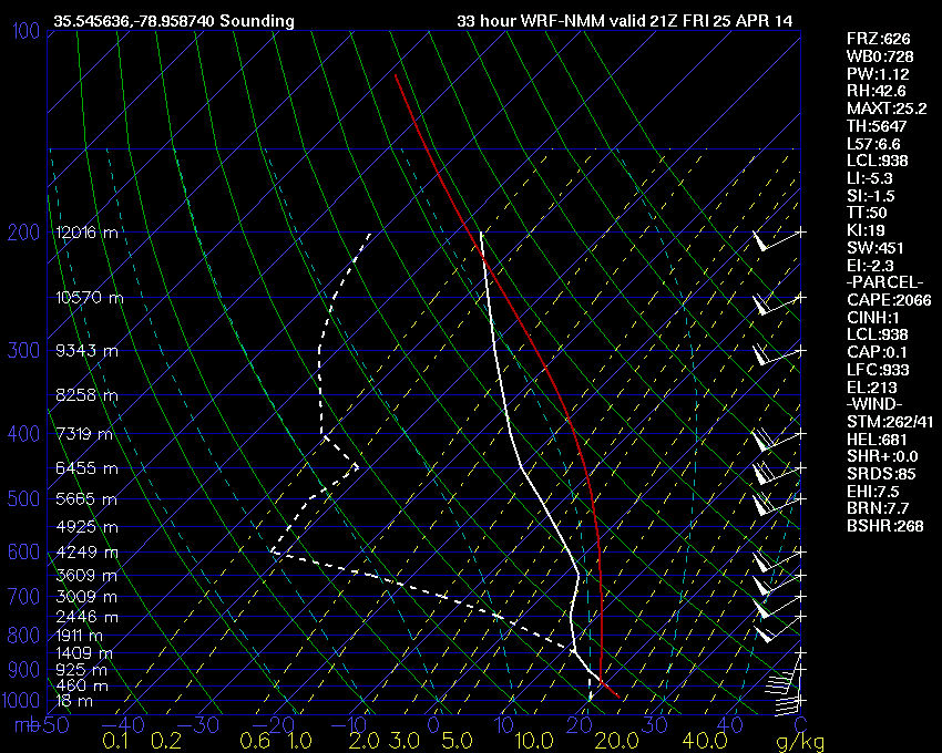
A Risk of Severe Thunderstorms With A Tornado Possible Across Central / Eastern NC/VA Friday Afternoon – Evening

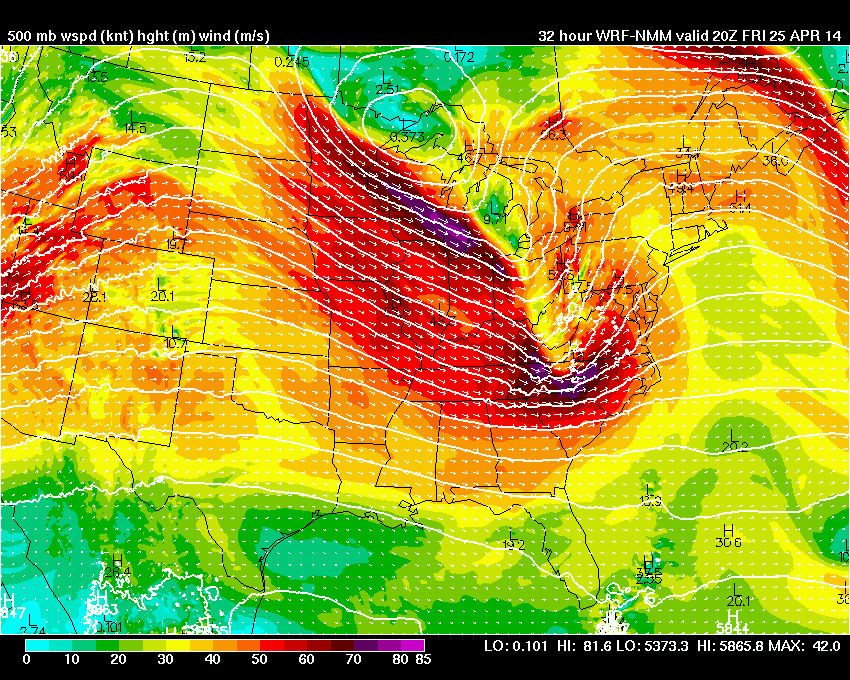
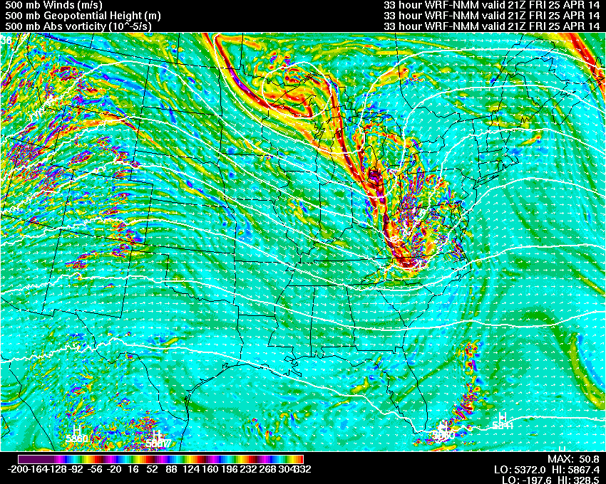
An upper level shortwave will move through the Mid-Atlantic region Friday evening. Ahead of this shortwave, conditions will for a short  period of time, become favorable for severe weather across Central and Eastern portions of the Carolinas and Virginia.

Thunderstorms will likely develop by mid day across the central portions of the region and move eastward and intensify under a strong mid-level flow. Moderate helicity and bulk-shear values along with surface CAPE in excess of 1500 will support the potential for supercell development. Low LCL levels will also increase the risk of tornadoes in the strongest supercells.    Trends in mid-level wind strength and instability should be monitored for an increase in the severe weather risk assessment.


-Mike
4/24/14 3:00 PM EDT


Damaging Ice Storm Likely Across Georgia, South Carolina

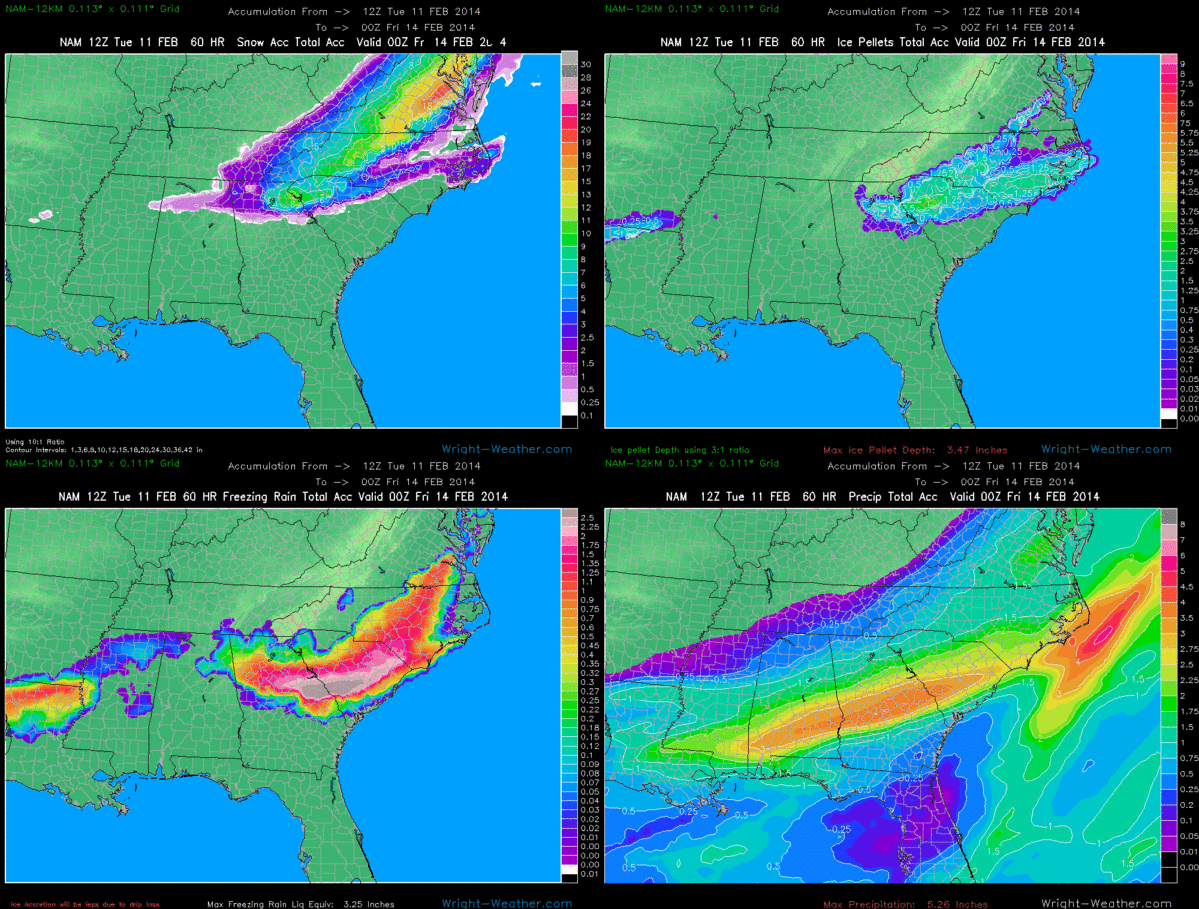
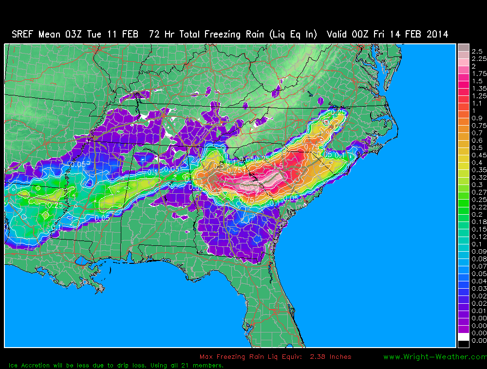
A zone of of prolonged freezing rain will extended the I-20 corridor from Atlanta to Augusta to Columbia, SC.  Model freezing rain liquid equivalent totals in this area exceed 2 inches. While drip loss will be relatively high with accretion efficiencies likely only being in the 30-40% range due to the high precipitation rates and the temperatures likely remaining close to the freezing point, this still yields  radial ice accretion amounts of .50-75″ which would cause widespread electrical distribution disruptions and tree damage.

Here are the latest Freezing Rain Graphics.

Major Winter Storm To Impact Southeast Then East Coast.

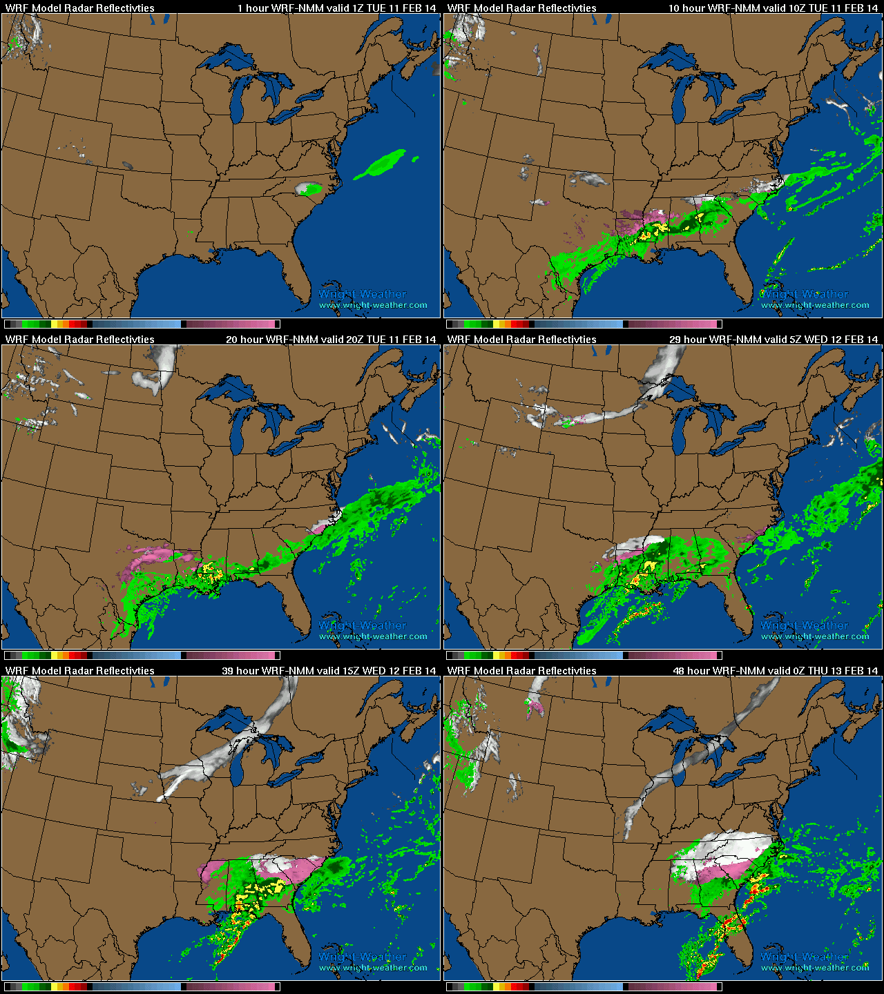
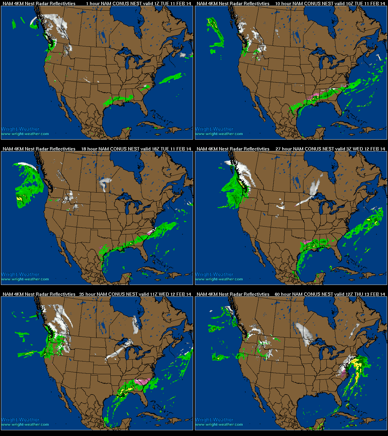
A strong winter storm will bring a variety of winter weather to the Southeastern U.S. as an upper level low develops across the mid-south, in combination with a cold air damming event.  A strong coastal low will strengthen and move up along and just off the Eastern seaboard and bring heavy precipitation to the Mid-Atlantic and into the Northeast

WRF Hourly Winter Radar through Wednesday Evening

NAM 4km 60hr Winter Radar

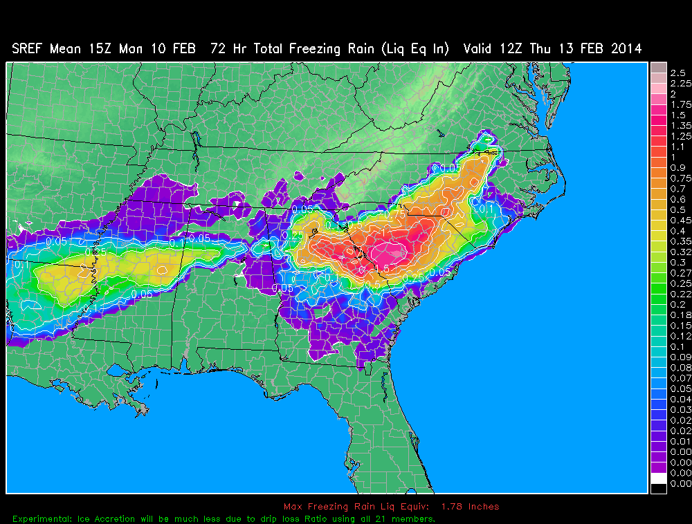
New SREF Accumulated Winter Precipitation Products

New Short Range Ensemble Forecast (SREF)  Mean Accumulated Winter Precipitation have been added.  They are:

Snow
Snow change from previous run (dProg/dt)
Ice Pellets (Sleet)
Freezing Rain

They can be found in the drop down menu on the SREF model page under “Forecast Parameter (Mean)” 

http://vmcluster.wright-weather.com/sref.shtml

Here is an example.  Freezing Rain Accumulation across the Southeast. 


Significant amounts of freezing rain likely across the New York City area tonight and early Wednesday

2/5/14 1:45 Z

Freezing rain will moving into the populated region of New Jersey and New York City around midnight (2/5/14) and will persist until around noon Wednesday.  Temperatures in the New York city metro area are expected to remain near or slightly below freezing the duration of the event. Just northwest and west of the downtown area, slightly colder surface temperatures are likely.

Total precipitation amounts of 1.00-1.25″ is expected. A significant amount of drip loss will occur due to the heavy precipitation rate and the small air temperature delta to freezing point.  Where temperatures are likely closer to 29 or 30 degrees just west and northwest of the city, ice accretion amounts of 1/4″ to as much as 1/2″ are possible and could lead to a significant amount of power outages, if ice accretion amounts surpass 1/3″.


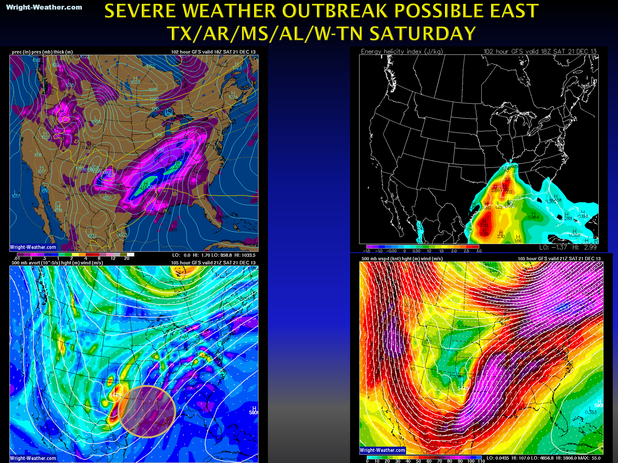
Severe weather outbreak possible Saturday for E-TX/AR/MS/AL

Quite a bit of uncertainty, but the latest data suggest the potential for severe thunderstorms and possible tornadoes across Eastern Texas and the Deep South Saturday as a strong, negatively tilted, shortwave ejects across Texas.  Stay tuned over the next couple of days if you live in this area.


Update: 12/20/13 12:40AM EST
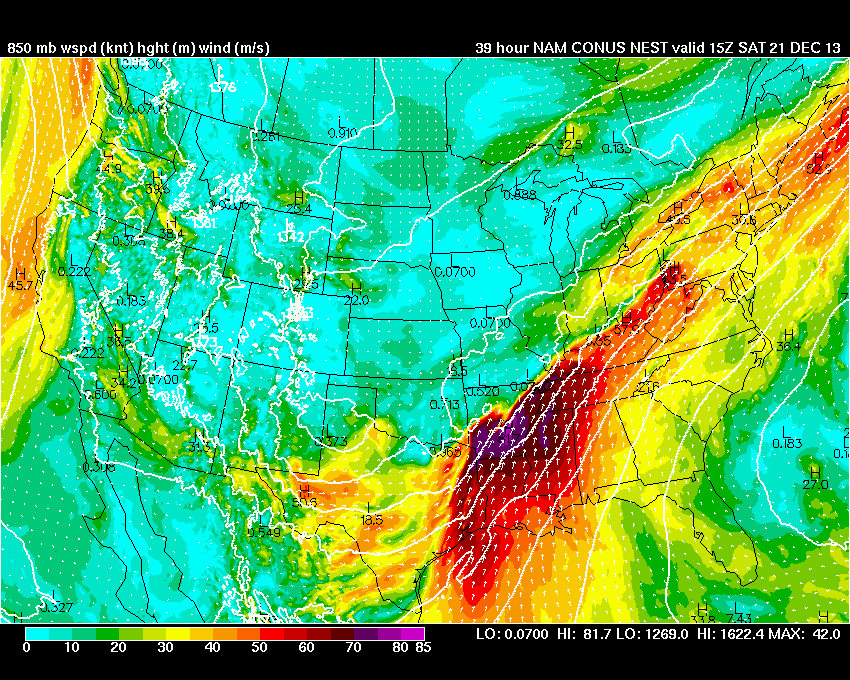
After reviewing the 00Z model guidance, it appears that the instability will be somewhat limited on Saturday, due to clouds and marginal lapse rates.  Severe thunderstorms with damaging winds are likely to develop across East Texas during the morning and spread quickly eastward during the day. 0-6Km shear vectors are large and 0-1km helicity values will be locally high,  so some low-top supercells are likely, including the risk of a few tornadoes. But given the expected limited instability, SFC CAPE <1000, a widespread outbreak of tornadic supercells seems unlikely.  The threat of damaging winds is high however, as the low level jet increase to over 70kts during morning and early afternoon.

850 Wind Late Saturday morning near 80 Knots
-Mike

(more…)